Canada · Frattura eruttiva
Endeavour Segment
- Tipo
- Frattura eruttiva
- Altitudine
- 2050 m (sottomarino)
- Ultima eruzione
- -3490
- Tipo
- Frattura eruttiva
- Paese
- Canada
- Regione
- Pacifico orientale / Northeast Pacific Rifts Volcanic Province
- Altitudine
- 2050 m (sottomarino)
- Coordinate
- 47.950, -129.100
- Ultima eruzione
- -3490
- Contesto tettonico
- Zona di rift / Crosta oceanica (< 15 km)
- Forma vulcanica
- Gruppo vulcanico
- Roccia principale
- Basalto / Picrobasalto
Sintesi geologica
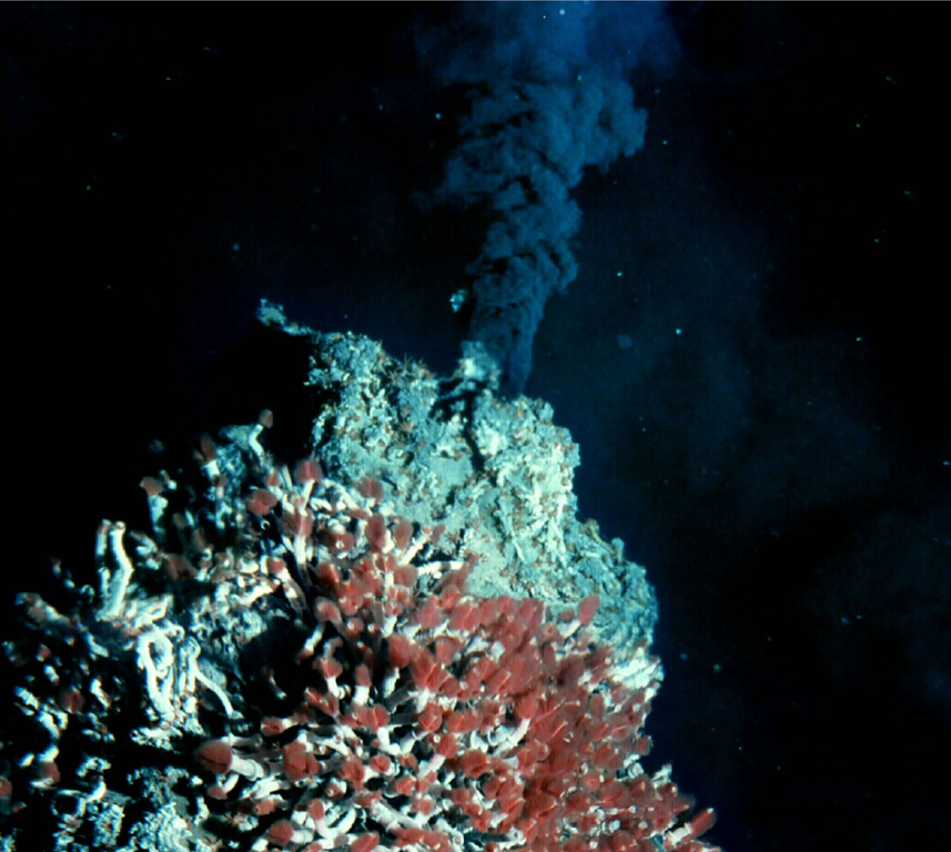
The Endeavour Segment (or Ridge) lies near the northern end of the Juan de Fuca Ridge, W of the coast of Washington and SW of Vancouver Island. The northern end is offset to the east with respect to the West Valley Segment, which extends north to the triple junction with the Sovanco Fracture Zone and the Nootka Fault. The 90-km-long, NNE-SSW-trending segment lies at a depth of more than 2,000 m and is the site of vigorous high-temperature hydrothermal vent systems that were discovered in 1981. Five major vent fields that include sulfide chimneys and black smoker vents are spaced at about 2-km intervals in a 1-km-wide axial valley at the center of the ridge. Preliminary uranium-series dates of Holocene age were obtained on basaltic lava flows, and other younger "zero-age" flows were sampled. Seismic swarms were detected in 1991 and 2005.
Storia delle eruzioni
2 registrateGlossarioCronologia dettagliata
- 3490 a.C.VEI 0Stima geologica3490 a.C. – fine sconosciuta
- 6930 a.C.VEI 0Stima geologica6930 a.C. – fine sconosciuta
Vulcani nelle vicinanze
Link esterni
- Non ancora su Wikipedia (Italiano). Puoi contribuire su Wikidata.
- Pagina originale Smithsonian GVP
⚠ Solo a scopo informativo. Non adatto a situazioni di emergenza.