本文へスキップ
地図に戻る
比較地図で見る

エチオピア · 成層火山

Gada Ale

タイプ
成層火山
標高
287m
最終噴火
不明
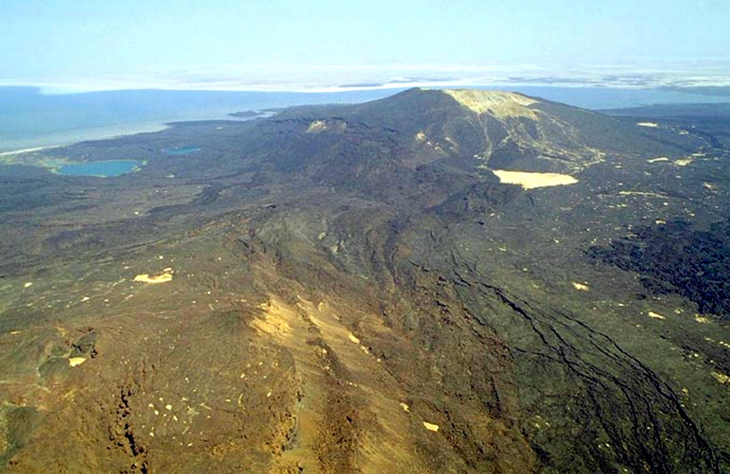
Gada Ale (upper right) is the most prominent volcano at the northern end of the Erta Ale Range. The 287-m-high volcano is seen here from the S, with two small lakes on its lower NW flank. Lake Aasale (Lake Karum) at about 116 m below sea level, is in the background. Prominent fissures (lower right) are adjacent to an uplifted salt dome (lower left). Salt diapir uplift has affected both this 2-km-wide area W of the volcano (where lava flows are uplifted as much as 100 m) and Gada Ale itself.
Gada Ale (upper right) is the most prominent volcano at the northern end of the Erta Ale Range. The 287-m-high volcano is seen here from the S, with two small lakes on its lower NW flank. Lake Aasale (Lake Karum) at about 116 m below sea level, is in the background. Prominent fissures (lower right) are adjacent to an uplifted salt dome (lower left). Salt diapir uplift has affected both this 2-km-wide area W of the volcano (where lava flows are uplifted as much as 100 m) and Gada Ale itself. · 写真: Copyrighted photo by Marco Fulle, 2002 (Stromboli On-Line, http://stromboli.net).
タイプ
成層火山
国
エチオピア
地域
東アフリカ / Afar Rift Volcanic Province
標高
287m
座標
13.975, 40.408
最終噴火
不明
テクトニクス環境
リフト帯 / 中間地殻 (15-25 km)
火山地形
複成火山
主要岩石
玄武岩 / ピクライト質玄武岩

地質学的概要

英語の原文

Gada Ale (also known as Kebrit Ale), the most prominent volcano at the northern end of the Erta Ale Range, is formed of interstratified lava flows and hyaloclastites.

出典:Global Volcanism Program, Smithsonian Institution(抜粋) · GVP で全文を読む →

Wikipedia の要約

英語版の要約

Gada Ale is a stratovolcano located in the Afar Region, Ethiopia.

Wikipedia · CC BY-SA · 英語版ウィキペディアで続きを読む →

噴火履歴

用語集

詳細タイムライン

噴火記録はありません。

近くの火山

外部リンク

⚠ 参考情報です。緊急対応には使用しないでください。