本文へスキップ
地図に戻る
比較地図で見る

エチオピア · 火山原

Liado

Liado Hayk

タイプ
火山原
標高
878m
最終噴火
不明
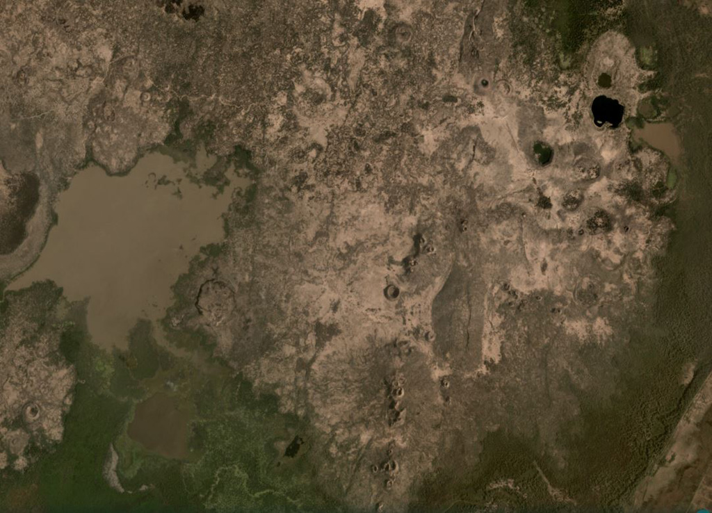
The Liado Hayk volcanic group contains maars and scoria cones visible across this February 2021 Planet Labs satellite image monthly mosaic (N is at the top; this image is approximately 13.5 km across). A cluster of maar craters is in the top right of this image, with some containing lakes, the largest of which is the darker-colored 600-m-wide lake. There are several linear groups of scoria cones and partly-buried lava flow fields around them.
The Liado Hayk volcanic group contains maars and scoria cones visible across this February 2021 Planet Labs satellite image monthly mosaic (N is at the top; this image is approximately 13.5 km across). A cluster of maar craters is in the top right of this image, with some containing lakes, the largest of which is the darker-colored 600-m-wide lake. There are several linear groups of scoria cones and partly-buried lava flow fields around them. · 写真: Satellite image courtesy of Planet Labs Inc., 2021 (https://www.planet.com/).
タイプ
火山原
国
エチオピア
地域
東アフリカ / Main Ethiopian Rift Volcanic Province
標高
878m
座標
9.570, 40.280
最終噴火
不明
テクトニクス環境
リフト帯 / 大陸地殻 (> 25 km)
火山地形
火山群
主要岩石
データなし
地質学的概要

The Liado Hayk (Liado Lake) volcanic field consists of a dozen closely spaced maars and cinder cones with associated lava fields in the Awash plain NE of Dofen volcano. The morphology of the cones and maars suggested a late Pleistocene or Holocene age (Wood, 1979 p.c.).

噴火履歴

用語集

詳細タイムライン

噴火記録はありません。

近くの火山

外部リンク

⚠ 参考情報です。緊急対応には使用しないでください。