本文へスキップ
地図に戻る
比較地図で見る

ニジェール · 火山原

Todra Volcanic Field

タイプ
火山原
標高
1780m
最終噴火
不明
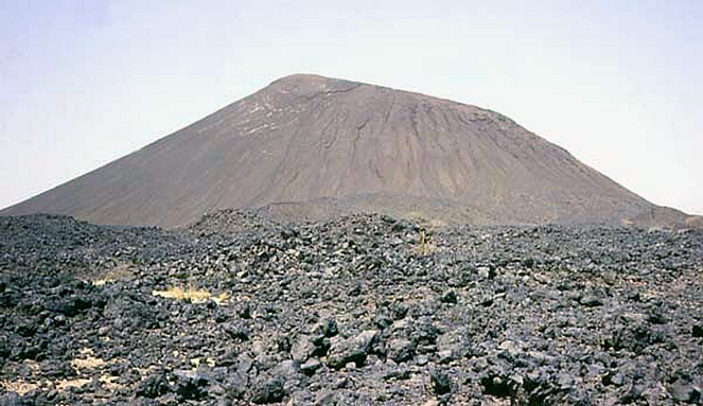
This small Aïr basaltic scoria cone and lava flow are part of the Todra volcanic field, which covers a broad area of about 1,050 km2 in the Tuareg shield in the southern Aïr region of Niger. Construction of about 30 volcanoes was followed by the formation of about 130 basaltic cones. The date of the latest eruption of the Todra volcanic field is not known, but may have been as recent as a few centuries ago.
This small Aïr basaltic scoria cone and lava flow are part of the Todra volcanic field, which covers a broad area of about 1,050 km2 in the Tuareg shield in the southern Aïr region of Niger. Construction of about 30 volcanoes was followed by the formation of about 130 basaltic cones. The date of the latest eruption of the Todra volcanic field is not known, but may have been as recent as a few centuries ago. · 写真: Photo by Jean-Paul Liégeois (Africa Museum, Belgium).
タイプ
火山原
国
ニジェール
地域
北アフリカ / West Central Sahara Volcanic Province
標高
1780m
座標
17.680, 8.500
最終噴火
不明
テクトニクス環境
プレート内部 / 大陸地殻 (> 25 km)
火山地形
火山群
主要岩石
玄武岩 / ピクライト質玄武岩
地質学的概要

The Todra Volcanic Field covers about 1,000 km2 in the Tuareg shield in the southern Aïr region of Niger. Activity began with the eruption of about 30 trachytic and phonolitic volcanoes through Precambrian basement rocks. This was followed by the formation of about 130 basaltic cones that typically produced valley-filling lava flows. A series of NW-SE faults control cone locations. The date of the latest eruption is not known, but may have been as recent as a few centuries ago.

噴火履歴

用語集

詳細タイムライン

噴火記録はありません。

近くの火山

外部リンク

⚠ 参考情報です。緊急対応には使用しないでください。