本文へスキップ
地図に戻る
比較地図で見る

トンガ · 複成火山

Curacoa volcano

Curacoa

タイプ
複成火山
標高
33m (海底)
最終噴火
1979年
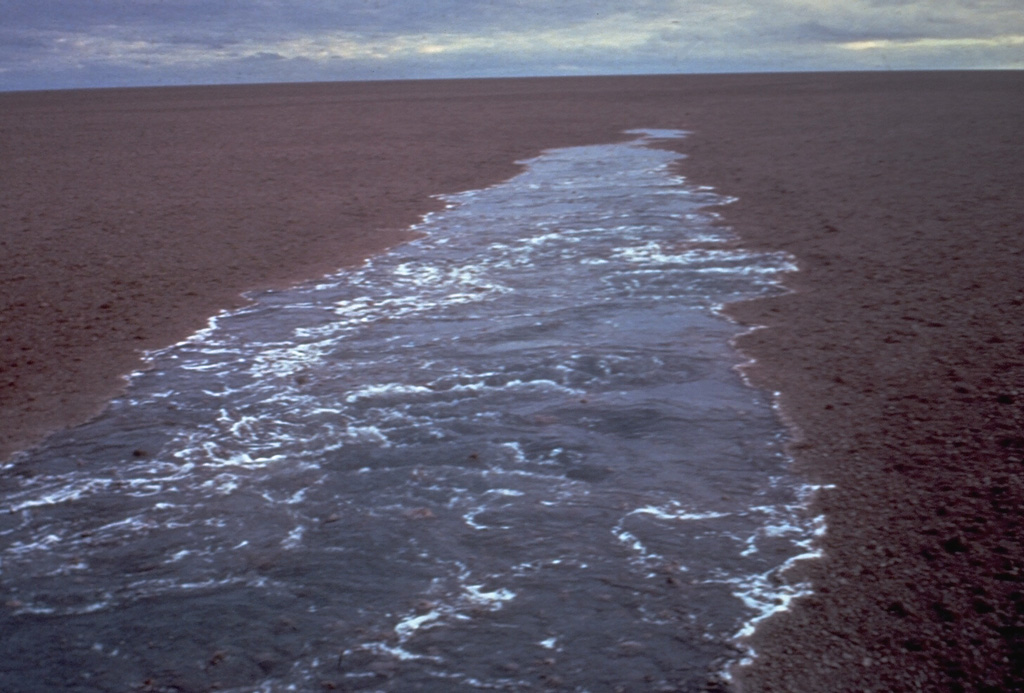
 A raft of floating pumice from a July 1973 submarine eruption behind the wake of a ship. This was the first report of an eruption from the Curacoa submarine volcano in the northern Tonga Islands. The pumice raft covered an area of more than 100 km2 and was encountered by a ship 200 km to the W nearly two weeks after the start of the eruption. Another eruption was observed in the same general area in 1979.
A raft of floating pumice from a July 1973 submarine eruption behind the wake of a ship. This was the first report of an eruption from the Curacoa submarine volcano in the northern Tonga Islands. The pumice raft covered an area of more than 100 km2 and was encountered by a ship 200 km to the W nearly two weeks after the start of the eruption. Another eruption was observed in the same general area in 1979. · 写真: Photo by the crew of the vessel "Port Nicholson," 1973 (courtesy of Tom Simkin, Smithsonian Institution).
タイプ
複成火山
国
トンガ
地域
トンガ・ケルマデック / Tofua Volcanic Arc
標高
33m (海底)
座標
-15.620, -173.670
最終噴火
1979年
テクトニクス環境
沈み込み帯 / 海洋地殻 (< 15 km)
火山地形
複成火山
主要岩石
デイサイト
地質学的概要

A submarine volcano south of Curacoa Reef at the northern end of the Tofua volcanic arc was first observed in eruption in 1973. Explosive eruptions, which produced large rafts of dacitic pumice, covering an area of more than 100 km2, were observed from the island of Tafahi, 27 km SSW. The eruption site was located about 6.5 km SW of Curacoa Reef. Multiple submarine vents are apparently located in this area; a second eruption was reported in 1979 from a location 13 km N of Tafahi.

噴火履歴

2件の記録用語集
概要 (VEI時系列)
バーをクリックすると個別の噴火が表示されます · 矢印キーで棒を移動、Enterで表示
1973~1974 · 1件 · 最大 VEI 31978~1979 · 1件 · 最大 VEI 119731974197619771978

詳細タイムライン

  1. 1979年VEI 1観測記録
    1979-05-14 ~ 終了日不明
    13 km north of Tafahi
  2. 1973年VEI 3観測記録
    1973-07-11 ~ 1973-07-16
    6.4 km SW of Curacoa Reef

近くの火山

外部リンク

⚠ 参考情報です。緊急対応には使用しないでください。