本文へスキップ
地図に戻る
比較地図で見る

パプアニューギニア · 複合火山

タクアン山

Takuan Group

タイプ
複合火山
標高
2210m
最終噴火
不明
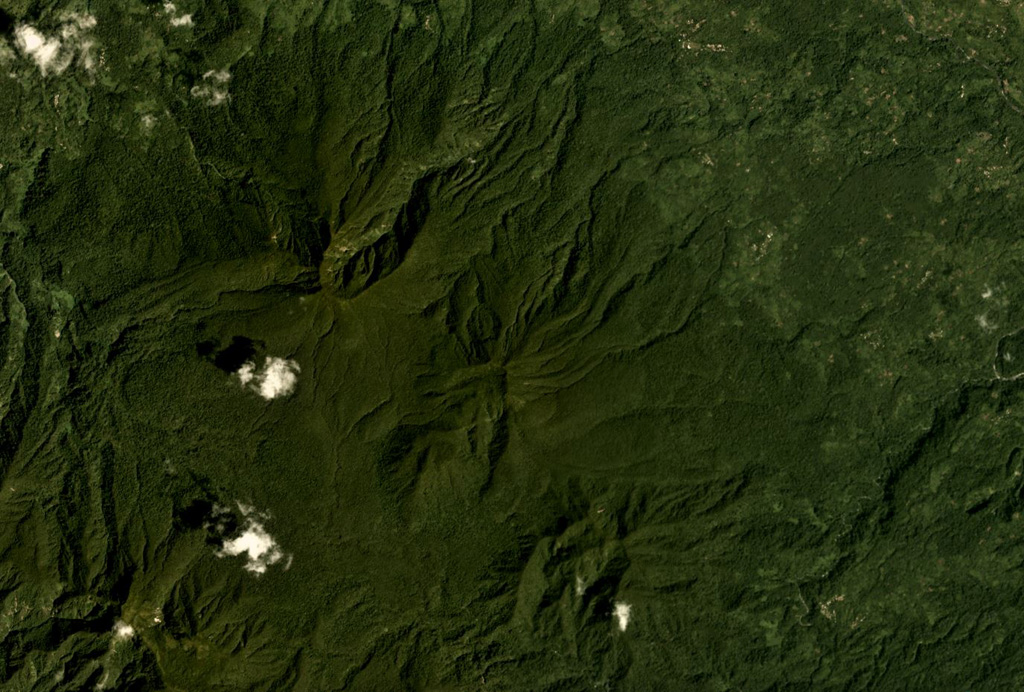
The Takuan Group in southern Bougainville Island, Papua New Guinea, is shown in this Planet Labs satellite image monthly mosaic (N is at the top; this image is approximately 12.5 km across). The group contains three edifices along a NW-SE trend, all of which have probable collapse scarps, and erosion on the flanks. The volcano in the center has a lava dome that has formed within the scarp.
The Takuan Group in southern Bougainville Island, Papua New Guinea, is shown in this Planet Labs satellite image monthly mosaic (N is at the top; this image is approximately 12.5 km across). The group contains three edifices along a NW-SE trend, all of which have probable collapse scarps, and erosion on the flanks. The volcano in the center has a lava dome that has formed within the scarp. · 写真: Satellite image courtesy of Planet Labs Inc., 2018 (https://www.planet.com/).
タイプ
複合火山
国
パプアニューギニア
地域
南西太平洋 / Bougainville Volcanic Arc
標高
2210m
座標
-6.442, 155.608
最終噴火
不明
テクトニクス環境
沈み込み帯 / 地殻の厚さ不明
火山地形
複成火山
主要岩石
安山岩 / 玄武岩質安山岩

地質学的概要

英語の原文

The Takuan volcano group in southern Bougainville Island consists of three closely spaced, NW-SE-trending andesitic-dacitic stratovolcanoes.

出典:Global Volcanism Program, Smithsonian Institution(抜粋) · GVP で全文を読む →

Wikipedia の要約

タクアン山系 は、パプアニューギニア・ブーゲンビル島の南部に位置する火山群。3つの成層火山から構成され、最も高いタクアン山 の標高は2,210メートル。タクアム山とも。最寄りの村は Kapikavi で、ブインからは約35キロメートル離れている。

Wikipedia · CC BY-SA · 記事全文を読む →

噴火履歴

用語集

詳細タイムライン

噴火記録はありません。

近くの火山

外部リンク

⚠ 参考情報です。緊急対応には使用しないでください。