フィリピン · 成層火山
カミギン・デ・バブヤネス
Camiguin de Babuyanes
- タイプ
- 成層火山
- 標高
- 712m
- 最終噴火
- 1857年
- タイプ
- 成層火山
- 国
- フィリピン
- 地域
- 西太平洋 / Luzon Volcanic Arc
- 標高
- 712m
- 座標
- 18.830, 121.860
- 最終噴火
- 1857年
- テクトニクス環境
- 沈み込み帯 / 地殻の厚さ不明
- 火山地形
- 複成火山
- 主要岩石
- 安山岩 / 玄武岩質安山岩
地質学的概要
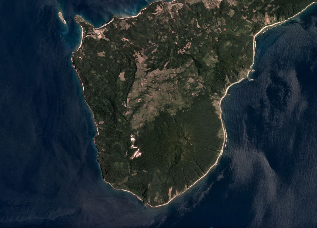
Forested Mount Camiguin occupies the SW tip of 22-km-long Camiguin Island in the Babuyan archipelago, north of Luzon Island. Following construction of an andesitic volcano during the Pliocene, the subsidiary cones of Minabul to the north and Caanoan to the east were constructed on the northern part of the island. The southern part of the island consists of three volcanic centers located along a SSE-NNW line, the andesitic Mount Camiguin stratovolcano and the young andesitic lava domes of Mt. Malabsing and Pamoctan. A phreatic eruption, possibly in part submarine, was reported from Camiguin de Babuyanes around 1857. Fumaroles are found on the SW, W, and E flanks of the volcano, and a boiling spring is located near sea level on the W flank.
噴火履歴
1件の記録用語集詳細タイムライン
- 1857年VEI 2観測記録1857-07-02 ~ 終了日不明SW flank
近くの火山
外部リンク
⚠ 参考情報です。緊急対応には使用しないでください。