本文へスキップ
地図に戻る
比較地図で見る

日本 · カルデラ

Kita-Bayonnaise

タイプ
カルデラ
標高
360m (海底)
最終噴火
不明
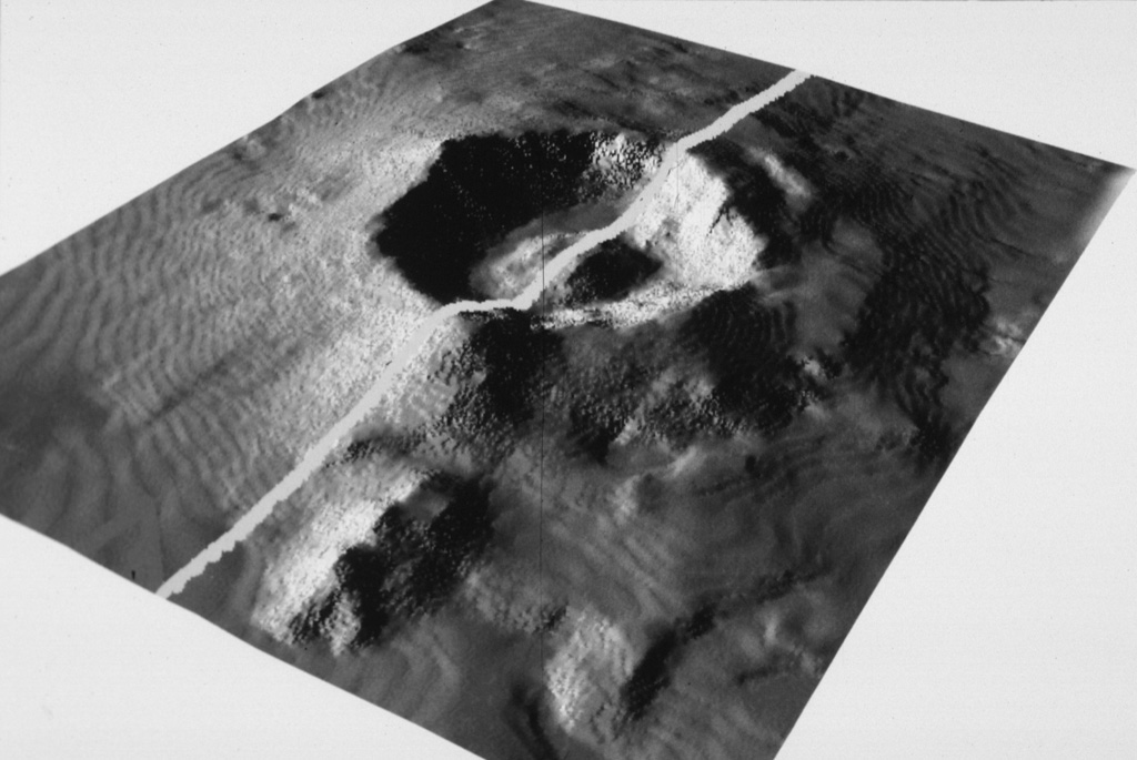
The submarine topography of the 6-7 km Myojin Knoll caldera is seen in this SeaBeam image viewed from the SW. The white line marks the E-W track of the survey vessel. A voluminous deposit of coarse pumice from the caldera-forming eruption mantles the caldera rim and its outer flanks. A post-caldera lava dome rises 250 m above the caldera floor.
The submarine topography of the 6-7 km Myojin Knoll caldera is seen in this SeaBeam image viewed from the SW. The white line marks the E-W track of the survey vessel. A voluminous deposit of coarse pumice from the caldera-forming eruption mantles the caldera rim and its outer flanks. A post-caldera lava dome rises 250 m above the caldera floor. · 写真: Image by Fumitoshi Murakami (Geological Survey of Japan, courtesy of Richard Fiske, Smithsonian Institution).
タイプ
カルデラ
国
日本
地域
北西太平洋 / Izu Volcanic Arc
標高
360m (海底)
座標
32.100, 139.850
最終噴火
不明
テクトニクス環境
沈み込み帯 / 海洋地殻 (< 15 km)
火山地形
カルデラ
主要岩石
流紋岩

地質学的概要

英語の原文

The large submarine Kita-Bayonnaise (North Bayonnaise) submarine caldera, also known as Myojin Knoll, lies between the Aogashima and Myojinsho (also called Beyonesu Rocks) calderas about 300 km SSE of the Izu Peninsula.

出典:Global Volcanism Program, Smithsonian Institution(抜粋) · GVP で全文を読む →

噴火履歴

用語集

詳細タイムライン

噴火記録はありません。

近くの火山

外部リンク

⚠ 参考情報です。緊急対応には使用しないでください。