日本 · 成層火山
北福徳堆
Kita-Fukutokutai
- タイプ
- 成層火山
- 標高
- 73m (海底)
- 最終噴火
- 1954年
- タイプ
- 成層火山
- 国
- 日本
- 地域
- 北西太平洋 / Ogasawara Volcanic Arc
- 標高
- 73m (海底)
- 座標
- 24.417, 141.417
- 最終噴火
- 1954年
- テクトニクス環境
- 沈み込み帯 / 地殻の厚さ不明
- 火山地形
- 複成火山
- 主要岩石
- データなし
地質学的概要
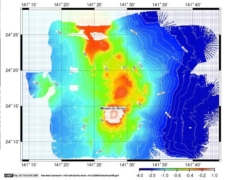
Kita-Fukutokutai is a submarine volcano halfway between the Ioto and Minami-Ioto islands. The volcano rises to within 73 m of the ocean surface. Water discoloration was reported several times beginning in 1937, and floating pumice was seen during 1953-54. In 1988 a fishing boat reported an eruption column about 100 m high, although the report was not confirmed at the time. The Japan Meteorological Agency has classified Kita-Fukutokutai as an active volcano.
噴火履歴
6件の記録用語集概要 (VEI時系列)
バーをクリックすると個別の噴火が表示されます · 矢印キーで棒を移動、Enterで表示
詳細タイムライン
- 2001年VEI 0根拠の記載なし2001-10-30 ~ 2001-10-3024.443 N, 141.378 E
- 1988年VEI 1根拠の記載なし1988-01-27 ~ 終了日不明
- 1959年VEI 0根拠の記載なし1959-07-02 ~ 終了日不明
- 1953年VEI 0観測記録1953-07-02 ~ 1954-07-02
- 1947年VEI 0根拠の記載なし1947-07-02 ~ 終了日不明
- 1937年VEI 0根拠の記載なし1937-07-02 ~ 終了日不明
近くの火山
外部リンク
- 日本語版Wikipediaには未登録です。Wikidataで作成できます。
- Smithsonian GVP 原典ページ
⚠ 参考情報です。緊急対応には使用しないでください。