本文へスキップ
地図に戻る
比較地図で見る

日本 (ロシアが施政) · 成層火山

小田萌山

Odamoisan [Tebenkov]

タイプ
成層火山
標高
1208m
最終噴火
不明
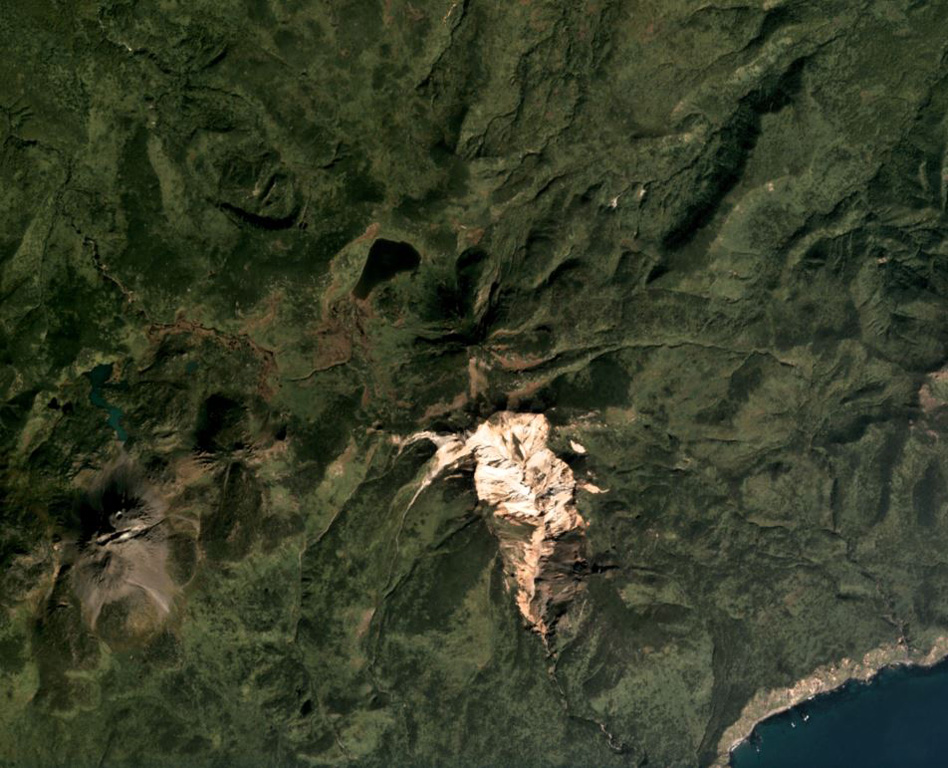
The vegetated summit of Odamoisan (also called Tebenkov) is in the center of this September 2019 Planet Labs satellite image monthly mosaic (N is at the top; this image is approximately 9 km across). South of the summit is the unvegetated Machekh crater with continuing geothermal activity. The unvegetated cone to the SW is Etorofu-Yakeyama, or the Grozny Group.
The vegetated summit of Odamoisan (also called Tebenkov) is in the center of this September 2019 Planet Labs satellite image monthly mosaic (N is at the top; this image is approximately 9 km across). South of the summit is the unvegetated Machekh crater with continuing geothermal activity. The unvegetated cone to the SW is Etorofu-Yakeyama, or the Grozny Group. · 写真: Satellite image courtesy of Planet Labs Inc., 2019 (https://www.planet.com/).
タイプ
成層火山
国
日本 (ロシアが施政)
地域
北西太平洋 / Kuril Volcanic Arc
標高
1208m
座標
45.029, 147.917
最終噴火
不明
テクトニクス環境
沈み込み帯 / 中間地殻 (15-25 km)
火山地形
複成火山
地質学的概要

Odamoisan (also known as Tebenkov), lies in the center of Iturup Island along the E coast. This forested andesitic volcano is ~4 km NE of the Etorofu-Yakeyama (Ivan Grozny) dome complex. A large eroded valley on the S side, named the Machekh crater, displays strong fumarolic activity and heavily altered surface deposts. There have been no observed eruptions.

Wikipedia の要約

要約が短いです。詳細は記事全文をご覧ください。

小田萌山(おだもいさん)は択捉島にある火山。

Wikipedia · CC BY-SA · 記事全文を読む →

噴火履歴

用語集

詳細タイムライン

噴火記録はありません。

近くの火山

外部リンク

⚠ 参考情報です。緊急対応には使用しないでください。