本文へスキップ
地図に戻る
比較地図で見る

アメリカ合衆国 · 火山原

St. Michael volcanic field

St. Michael

タイプ
火山原
標高
715m
最終噴火
不明
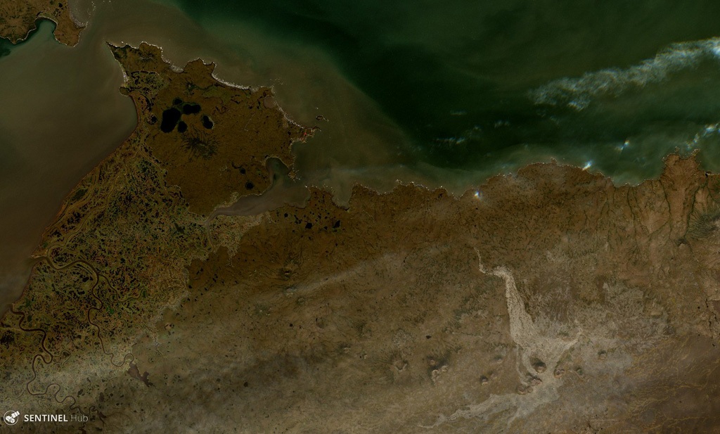
The St. Michael volcanic field consists of more than 55 cones and craters across Stuart Island (upper left) and the peninsula in the center of this  18 August 2020 Sentinel-2 satellite image (N is at the top; this image is approximately 40 km across). The field covers more than 3,000 km2. The Stuart Hill cone is visible in the eastern side of Stuart island, and St. Michael Mountain is in the center of the peninsula area.
The St. Michael volcanic field consists of more than 55 cones and craters across Stuart Island (upper left) and the peninsula in the center of this 18 August 2020 Sentinel-2 satellite image (N is at the top; this image is approximately 40 km across). The field covers more than 3,000 km2. The Stuart Hill cone is visible in the eastern side of Stuart island, and St. Michael Mountain is in the center of the peninsula area. · 写真: Satellite image courtesy of Copernicus Sentinel Data, 2019.
タイプ
火山原
国
アメリカ合衆国
地域
北アメリカ / Northern Alaska-Bering Sea Volcanic Province
標高
715m
座標
63.450, -162.120
最終噴火
不明
テクトニクス環境
プレート内部 / 大陸地殻 (> 25 km)
火山地形
火山群
主要岩石
玄武岩 / ピクライト質玄武岩

地質学的概要

英語の原文

The St. Michael volcanic field, at the south end of Norton Sound, includes more than 55 cones and craters on St. Michael and Stuart islands.

出典:Global Volcanism Program, Smithsonian Institution(抜粋) · GVP で全文を読む →

Wikipedia の要約

英語版の要約

The St. Michael volcanic field is a volcanic field located on St. Michael and Stuart Islands in western Alaska, United States.

Wikipedia · CC BY-SA · 英語版ウィキペディアで続きを読む →

噴火履歴

用語集

詳細タイムライン

噴火記録はありません。

近くの火山

外部リンク

⚠ 参考情報です。緊急対応には使用しないでください。