アメリカ合衆国 · 割れ目火口
Escanaba Segment
- タイプ
- 割れ目火口
- 標高
- 1700m (海底)
- 最終噴火
- -2260年
- タイプ
- 割れ目火口
- 国
- アメリカ合衆国
- 地域
- 東太平洋 / Northeast Pacific Rifts Volcanic Province
- 標高
- 1700m (海底)
- 座標
- 40.980, -127.500
- 最終噴火
- -2260年
- テクトニクス環境
- リフト帯 / 海洋地殻 (< 15 km)
- 火山地形
- 火山群
- 主要岩石
- 玄武岩 / ピクライト質玄武岩
地質学的概要
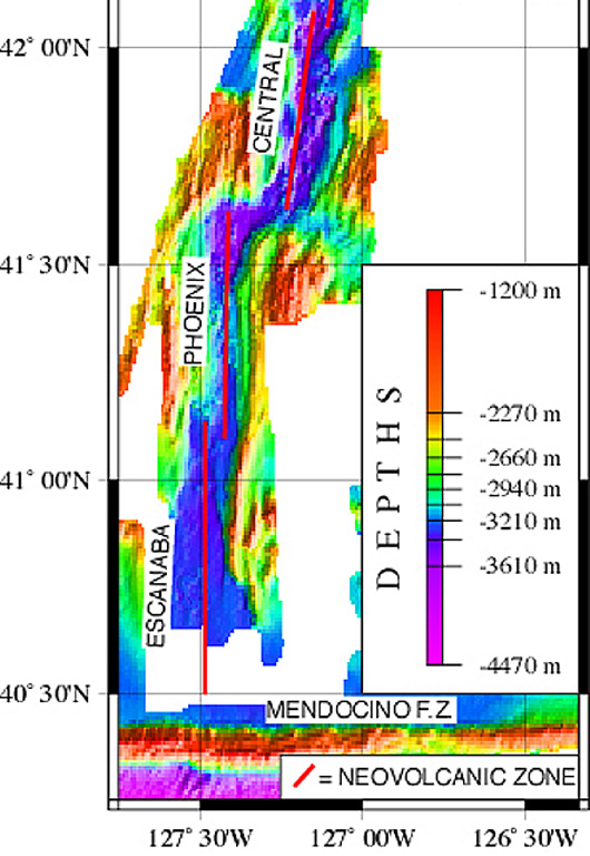
The linear, N-S-trending Escanaba Segment, the southernmost of the Gorda Ridge, lies immediately north of the Mendocino Fracture Zone off the coast of northern California. The axial crest of the 130-km-long segment, also known as the Escanaba Trough, is about 3-5 km wide at the northern end and increases to 18 km to the south near the junction with the Mendocino FZ. The rift valley floor of the slow-spreading segment lies at about 3,200 m depth, bounded by faulted walls about 1,500 m high with unusual gold-bearing massive sulfide deposits in sediment hills at the base of the scarps uplifted by volcanic sills or laccoliths. Thick sediment deposits from the continental margin enter the axial trough from the fracture zone and thin to the north. A preliminary uranium-series date of Holocene age was obtained from a basaltic lava flow in the axial valley in the less-sedimented northern part.
噴火履歴
1件の記録用語集詳細タイムライン
- 紀元前 2260年VEI 0地質学的推定紀元前 2260 ~ 終了日不明40 deg 59 min North
近くの火山
外部リンク
- 日本語版Wikipediaには未登録です。Wikidataで作成できます。
- Smithsonian GVP 原典ページ
⚠ 参考情報です。緊急対応には使用しないでください。