本文へスキップ
地図に戻る
比較地図で見る

アルゼンチン · 成層火山

Risco Plateado

タイプ
成層火山
標高
4999m
最終噴火
不明
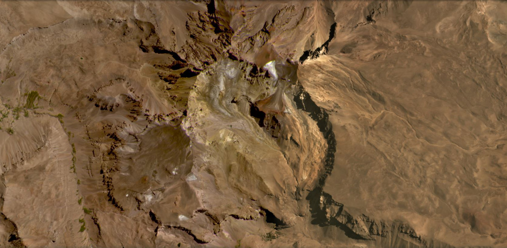
Risco Plateado covers an area of 910 km2 and has a steep mountainous relief partly due to glacial erosion, shown in this February 2021 Planet Labs satellite image monthly mosaic (N is at the top; this image is approximately 15 km across). there is a scoria cone on the SE flank, visible in the lower right corner of the image.
Risco Plateado covers an area of 910 km2 and has a steep mountainous relief partly due to glacial erosion, shown in this February 2021 Planet Labs satellite image monthly mosaic (N is at the top; this image is approximately 15 km across). there is a scoria cone on the SE flank, visible in the lower right corner of the image. · 写真: Satellite image courtesy of Planet Labs Inc., 2021 (https://www.planet.com/).
タイプ
成層火山
国
アルゼンチン
地域
南アメリカ / Southern Andean Volcanic Arc
標高
4999m
座標
-34.917, -69.981
最終噴火
不明
テクトニクス環境
沈み込み帯 / 大陸地殻 (> 25 km)
火山地形
複成火山
主要岩石
安山岩 / 玄武岩質安山岩

地質学的概要

英語の原文

The Risco Plateado volcanic complex lies about 10 km S of the Caldera del Atuel and consists of a stratovolcano cut by a 4-km-wide caldera.

出典:Global Volcanism Program, Smithsonian Institution(抜粋) · GVP で全文を読む →

Wikipedia の要約

英語版の要約

Risco Plateado is a stratovolcano in Argentina, with an elevation of 4,999 metres (16,401 ft) above sea level.

Wikipedia · CC BY-SA · 英語版ウィキペディアで続きを読む →

噴火履歴

用語集

詳細タイムライン

噴火記録はありません。

近くの火山

外部リンク

⚠ 参考情報です。緊急対応には使用しないでください。