本文へスキップ
地図に戻る
比較地図で見る

チリ · 成層火山

Lomas Blancas

Blancas, Lomas

タイプ
成層火山
標高
2268m
最終噴火
不明
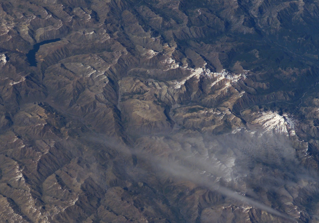
The small light-brown area at the center of this NASA International Space Station image (with north to the bottom right) is Volcán Lomas Blancas.  This small shield-like 2268-m-high stratovolcano of late-Pleistocene to Holocene age is located about 15 km SE of snow-capped Nevado de Longaví volcano (right-center).  A 2.3-km-wide caldera, possibly formed by edifice collapse, can been seen opening to the SE.  Pumice deposits probably originating from Nevado de Longaví blanket the volcano.  The crescent-shaped lake at the upper left is Laguna del Dial.
The small light-brown area at the center of this NASA International Space Station image (with north to the bottom right) is Volcán Lomas Blancas. This small shield-like 2268-m-high stratovolcano of late-Pleistocene to Holocene age is located about 15 km SE of snow-capped Nevado de Longaví volcano (right-center). A 2.3-km-wide caldera, possibly formed by edifice collapse, can been seen opening to the SE. Pumice deposits probably originating from Nevado de Longaví blanket the volcano. The crescent-shaped lake at the upper left is Laguna del Dial. · 写真: NASA International Space Station image ISS008-E-7432, 2003 (http://eol.jsc.nasa.gov/).
タイプ
成層火山
国
チリ
地域
南アメリカ / Southern Andean Volcanic Arc
標高
2268m
座標
-36.286, -71.009
最終噴火
不明
テクトニクス環境
沈み込み帯 / 大陸地殻 (> 25 km)
火山地形
複成火山
主要岩石
玄武岩 / ピクライト質玄武岩
地質学的概要

Volcán Lomas Blancas is a small shield-like feature of late-Pleistocene to Holocene age (Moreno and Naranjo, 1991) located about 15 km SE of Nevado de Longaví. An open scarp to the SE side extends about 2.3 km from the summit. The central cone is basaltic. basaltic andesite aa lava flows extend 7 km from the scarp. Much of the volcano is covered by pumice deposits that probably originated from Nevado de Longaví.

噴火履歴

用語集

詳細タイムライン

噴火記録はありません。

近くの火山

外部リンク

⚠ 参考情報です。緊急対応には使用しないでください。