チリ · 火山原
Meullin
- タイプ
- 火山原
- 標高
- 1080m
- 最終噴火
- 不明
- タイプ
- 火山原
- 国
- チリ
- 地域
- 南アメリカ / Southern Andean Volcanic Arc
- 標高
- 1080m
- 座標
- -45.220, -73.050
- 最終噴火
- 不明
- テクトニクス環境
- 沈み込み帯 / 大陸地殻 (> 25 km)
- 火山地形
- 火山群
- 主要岩石
- 玄武岩 / ピクライト質玄武岩
地質学的概要
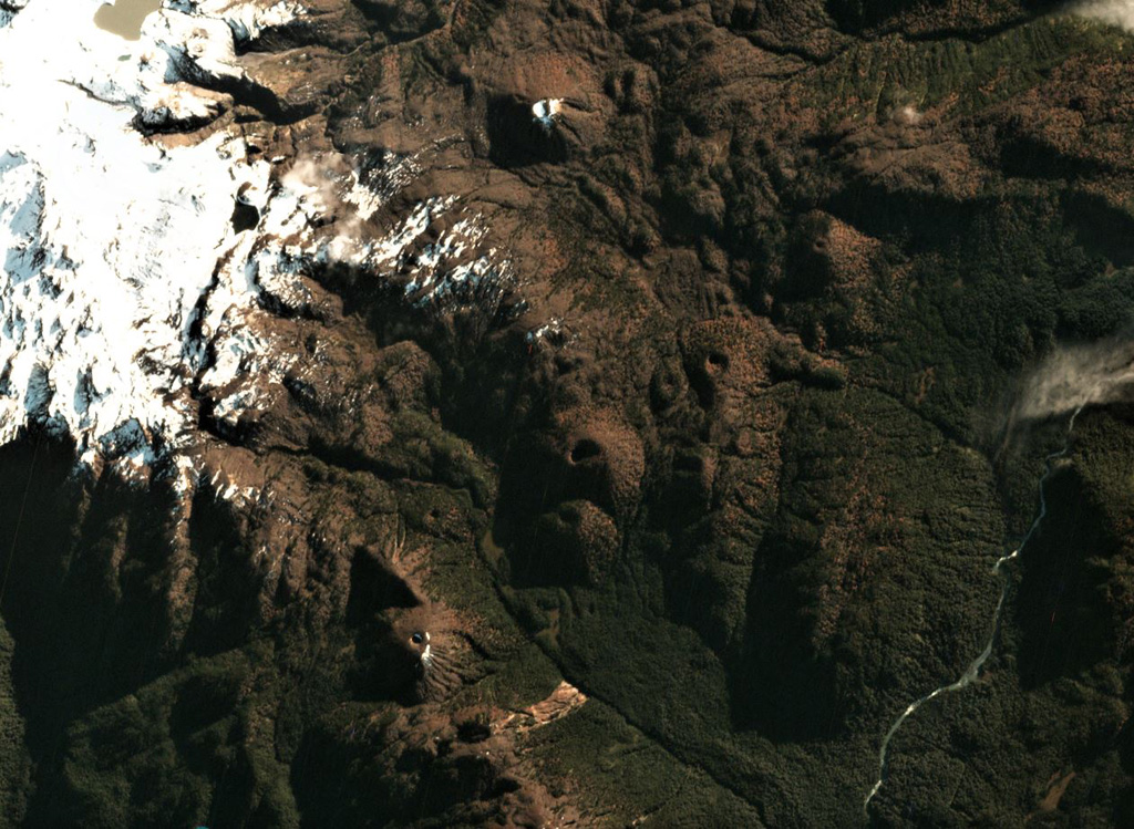
The Meullín volcanic field consists of a chain of well-preserved cinder cones along the Lago Meullín, Lago Yulton, Río Cuervo, and Quitralco fault segments of the regional Liquine-Ofqui fault zone. The cones straddle both sides of the Aisén (Aysén) Fjord and were considered to be of Holocene age (Vargas et al., 2013). The cinder cones, a few of which are sub-aquatic, extend to the south along NE-SW, NNE-SSW, and N-S lines from Yulton Lake. The largest concentration of cones lies between Meullín Lake and the older Pleistocene Meullín volcano located west of the volcanic field, and additional forested cinder cones were constructed along the Río Pescado valley south of Aisén Fjord.
噴火履歴
用語集詳細タイムライン
噴火記録はありません。
近くの火山
外部リンク
- 日本語版Wikipediaには未登録です。Wikidataで作成できます。
- Smithsonian GVP 原典ページ
⚠ 参考情報です。緊急対応には使用しないでください。