본문으로 건너뛰기

에티오피아 · 열극 분화구

East Zway

East Ziway

화산 유형
열극 분화구
해발
1889m
마지막 분화
미확인
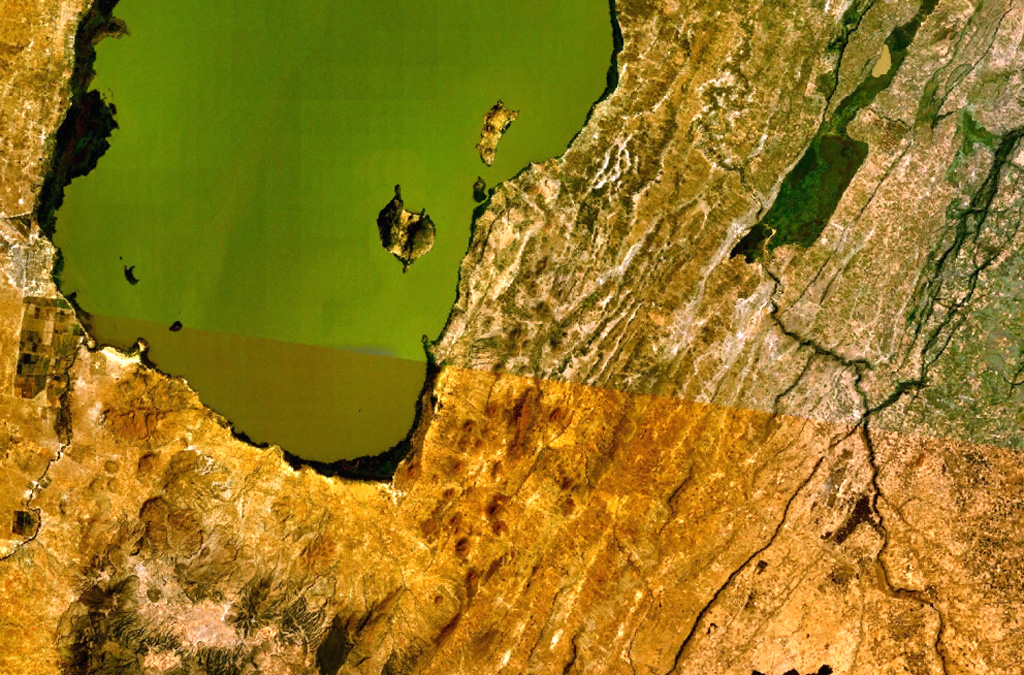
A large area of Holocene cinder cones and lava flows lies immediately east and south of Zway Lake (bottom) and forms islands along its eastern shore in this NASA Landsat mosaic (with north to the top). Faulting along the East Zway segment of the Wonji Fault Belt is seen cutting horizontally across the bottom of the image. The dark-colored Alutu volcanic complex lies the lower left. The 15 x 30 km wide Zway (also spelled Zwai, Zeway, or Ziway) lake occupies the central Ethiopian Rift.
A large area of Holocene cinder cones and lava flows lies immediately east and south of Zway Lake (bottom) and forms islands along its eastern shore in this NASA Landsat mosaic (with north to the top). Faulting along the East Zway segment of the Wonji Fault Belt is seen cutting horizontally across the bottom of the image. The dark-colored Alutu volcanic complex lies the lower left. The 15 x 30 km wide Zway (also spelled Zwai, Zeway, or Ziway) lake occupies the central Ethiopian Rift. · 사진: NASA Landsat 7 image (worldwind.arc.nasa.gov)
화산 유형
열극 분화구
국가
에티오피아
지역
동아프리카 / Main Ethiopian Rift Volcanic Province
해발
1889m
좌표
7.874, 38.902
마지막 분화
미확인
판구조 환경
열곡대 / 대륙 지각 (> 25 km)
화산 지형
화산군
주요 암석
현무암 / 피크로현무암
지질학적 요약

A large area of basaltic cinder cones and lava flows lies within about 5 km of the SE shore of Lake Ziway, and also forms islands along its E shore. About 80 vents were formed along the East Ziway segment of the Wonji Fault Belt. The youngest lava flows have been unaffected by the latest tectonic faulting along the Ethiopian Rift.

분화 이력

용어집

상세 타임라인

분화 기록이 없습니다.

주변 화산

외부 링크

⚠ 참고용 정보입니다. 재난 대응에 사용하지 마세요.