본문으로 건너뛰기

에티오피아 · 화산군

Northern Lake Abaya Volcanic Field

화산 유형
화산군
해발
1594m
마지막 분화
미확인
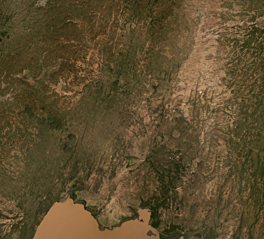
Northern Lake Abaya Volcanic Field is largely between Lake Abaya in the bottom of this image and the eroded Duguna volcano in the top center of this November 2020 Planet Labs satellite image monthly mosaic (N is at the top; this image is approximately 52 km across). The majority of the central area is recent lava flows from scoria cones with NNE-SSW-trending faults throughout. Hyaloclastite deposits are just north of this image and the 1.8-km-wide crater NNE of the lake is Chiracha volcano.
Northern Lake Abaya Volcanic Field is largely between Lake Abaya in the bottom of this image and the eroded Duguna volcano in the top center of this November 2020 Planet Labs satellite image monthly mosaic (N is at the top; this image is approximately 52 km across). The majority of the central area is recent lava flows from scoria cones with NNE-SSW-trending faults throughout. Hyaloclastite deposits are just north of this image and the 1.8-km-wide crater NNE of the lake is Chiracha volcano. · 사진: Satellite image courtesy of Planet Labs Inc., 2020 (https://www.planet.com/).
화산 유형
화산군
국가
에티오피아
지역
동아프리카 / Main Ethiopian Rift Volcanic Province
해발
1594m
좌표
6.760, 37.970
마지막 분화
미확인
판구조 환경
판 내부 / 대륙 지각 (> 25 km)
화산 지형
화산군
지질학적 요약

The Northern Lake Abaya volcanic field consists primarily of small Quaternary cones and basaltic lava flows between Doguna volcano to the north, Chericha to the E, Lake Abaya to the south, and the Hobitcha caldera to the west. The 3.5-km-long rhyolitic dome area immediately SE of the Hobitcha caldera trachytic ridge includes recent obsidian flows from vents at Hako and Salewa Dore (Corti et al., 2013).

분화 이력

용어집

상세 타임라인

분화 기록이 없습니다.

주변 화산

외부 링크

⚠ 참고용 정보입니다. 재난 대응에 사용하지 마세요.