예멘 · 화산군
Harra of Arhab
Arhab, Harra of
- 화산 유형
- 화산군
- 해발
- 3100m
- 마지막 분화
- 500년
- 화산 유형
- 화산군
- 국가
- 예멘
- 지역
- 아라비아·중앙아시아 / Southwest Arabia Volcanic Province
- 해발
- 3100m
- 좌표
- 15.602, 44.098
- 마지막 분화
- 500년
- 판구조 환경
- 판 내부 / 대륙 지각 (> 25 km)
- 화산 지형
- 화산군
- 주요 암석
- 조면현무암 / 테프라이트 바사나이트
지질학적 요약
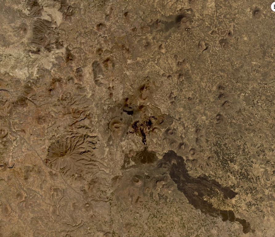
The Quaternary Harra of Arhab in Yemen, north of the capital city of Sana'a, consists of a 1,500 km2 basaltic plateau capped by a few small stratovolcanoes and about 60 scoria cones, two of which have erupted in historical time. Cones in the volcanic field (also known as the Sana'a or the Sana'a-Amran volcanic field) are commonly aligned along a NNW trend above a 100-250-m-thick volcanic plateau. Pliocene-to-Holocene volcanic rocks have a dominantly basaltic-to-hawaiitic composition and overlie the northern end of an area of extensive Oligocene-Miocene basaltic-to-rhyolitic rocks that extends to the SW tip of the Arabian Peninsula. Baker et al. (1997) include outcrops of Quaternary volcanism south of the main area of lava flows, such as Jabal al Marha, as part of this system, but note that they can be difficult to distinguish from Oligocene flood basalts. The latest eruption took place between about 400 and 600 CE and produced a lava flow that traveled 9 km.
Wikipedia 요약
영어 요약The mainly Quaternary Harra of Arhab is the northernmost, historically active volcanic field in Yemen. Also known as the "Sana'a-'Amran volcanic field", or simply the "Sana'a volcanic field", it has erupted in ancient times.
Wikipedia · CC BY-SA · 전체 기사 보기 →
분화 이력
2건 기록용어집상세 타임라인
- 500년 (±100년)VEI 0관측 기록500 ~ 종료일 미상South flank of Kaulet Hattab
- 200년VEI 2지질학적 추정200 ~ 종료일 미상East flank of Jabal Zebib
주변 화산
외부 링크
⚠ 참고용 정보입니다. 재난 대응에 사용하지 마세요.