뉴질랜드 · 성층화산
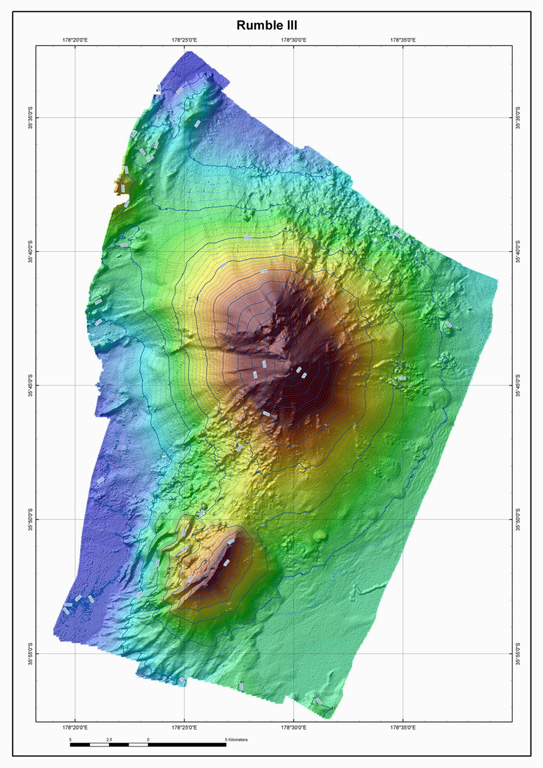
Rumble III Seamount
Rumble III
- 화산 유형
- 성층화산
- 해발
- 220m (해저)
- 마지막 분화
- 2008년
- 화산 유형
- 성층화산
- 국가
- 뉴질랜드
- 지역
- 통가·케르마덱 / Southern Kermadec Volcanic Arc
- 해발
- 220m (해저)
- 좌표
- -35.745, 178.478
- 마지막 분화
- 2008년
- 판구조 환경
- 섭입대 / 해양 지각 (< 15 km)
- 화산 지형
- 복성화산체
- 주요 암석
- 안산암 / 현무암질 안산암
지질학적 요약
Rumble III seamount, the largest of the Rumbles group of submarine volcanoes along the South Kermadec Ridge, rises 2,300 m from the seafloor to within about 200 m of the surface. Collapse of the edifice produced a scarp open to the west and a large debris-avalanche deposit. Fresh-looking andesitic rocks have been dredged from the summit and basaltic lava from its flanks. It has been the source of several submarine eruptions detected by hydrophone signals.
분화 이력
6건 기록용어집요약 (VEI 시계열)
막대를 클릭하면 개별 분화가 표시됩니다 · 화살표 키로 막대 이동, Enter로 열기
상세 타임라인
- 2008년 (±1년)VEI 0관측 기록2008-07-02 ~ 종료일 미상
- 1986년VEI 0관측 기록1986-06-15 ~ 1986-08-05
- 1973년VEI 0관측 기록1973-10-15 ~ 1973-10-17
- 1970년VEI 0관측 기록1970-07-02 ~ 종료일 미상
- 1963년VEI 0관측 기록1963-01-16 ~ 1966-12-16
- 1958년VEI 0관측 기록1958-07-09 ~ 1962-07-02
주변 화산
외부 링크
- 한국어 Wikipedia에 아직 기사가 없습니다. Wikidata에서 작성할 수 있습니다.
- Smithsonian GVP 원본 페이지
⚠ 참고용 정보입니다. 재난 대응에 사용하지 마세요.