일본 · 성층화산
Kita-Fukutokutai
- 화산 유형
- 성층화산
- 해발
- 73m (해저)
- 마지막 분화
- 1954년
- 화산 유형
- 성층화산
- 국가
- 일본
- 지역
- 북서태평양 / Ogasawara Volcanic Arc
- 해발
- 73m (해저)
- 좌표
- 24.417, 141.417
- 마지막 분화
- 1954년
- 판구조 환경
- 섭입대 / 지각 두께 미상
- 화산 지형
- 복성화산체
- 주요 암석
- 자료 없음
지질학적 요약
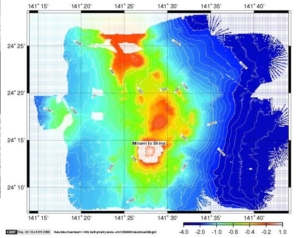
Kita-Fukutokutai is a submarine volcano halfway between the Ioto and Minami-Ioto islands. The volcano rises to within 73 m of the ocean surface. Water discoloration was reported several times beginning in 1937, and floating pumice was seen during 1953-54. In 1988 a fishing boat reported an eruption column about 100 m high, although the report was not confirmed at the time. The Japan Meteorological Agency has classified Kita-Fukutokutai as an active volcano.
분화 이력
6건 기록용어집요약 (VEI 시계열)
막대를 클릭하면 개별 분화가 표시됩니다 · 화살표 키로 막대 이동, Enter로 열기
상세 타임라인
- 2001년VEI 0근거 미기재2001-10-30 ~ 2001-10-3024.443 N, 141.378 E
- 1988년VEI 1근거 미기재1988-01-27 ~ 종료일 미상
- 1959년VEI 0근거 미기재1959-07-02 ~ 종료일 미상
- 1953년VEI 0관측 기록1953-07-02 ~ 1954-07-02
- 1947년VEI 0근거 미기재1947-07-02 ~ 종료일 미상
- 1937년VEI 0근거 미기재1937-07-02 ~ 종료일 미상
주변 화산
외부 링크
- 한국어 Wikipedia에 아직 기사가 없습니다. Wikidata에서 작성할 수 있습니다.
- Smithsonian GVP 원본 페이지
⚠ 참고용 정보입니다. 재난 대응에 사용하지 마세요.