러시아 · 마르
Kinenin
- 화산 유형
- 마르
- 해발
- 583m
- 마지막 분화
- 850년
- 화산 유형
- 마르
- 국가
- 러시아
- 지역
- 북서태평양 / Central Kamchatka Volcanic Arc
- 해발
- 583m
- 좌표
- 57.350, 160.970
- 마지막 분화
- 850년
- 판구조 환경
- 섭입대 / 대륙 지각 (> 25 km)
- 화산 지형
- 소규모
- 주요 암석
- 현무암 / 피크로현무암
지질학적 요약
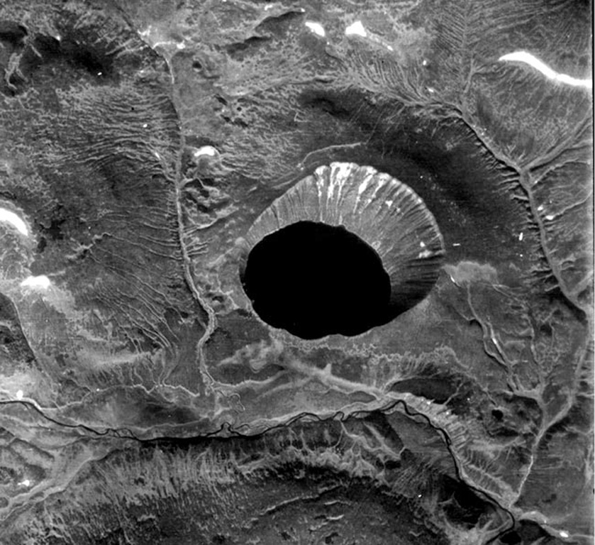
영어 원문Kinenin maar lies at the eastern foot of the Sredinny Range, about 80 km NNW of Sheveluch volcano. The 2.5-km-wide, funnel-shaped maar was formed along the Kinenin River, a tributary of the Elovka.
출처: Global Volcanism Program, Smithsonian Institution (발췌) · GVP에서 전체 요약 읽기 →
분화 이력
1건 기록용어집기록 요약
- 확인된 분화
- 1건
- 불확실한 분화
- 0건
- 확인된 기록 범위
- 850년 (±50년) ~ 850년
- 가장 큰 확인된 분화
- VEI 4 (850년)
- 1900년 이후 확인된 분화
- 0건
요약 (VEI 시계열)
막대를 클릭하면 개별 분화가 표시됩니다 · 화살표 키로 막대 이동, Enter로 열기
상세 타임라인
- 850년 (±50년)VEI 4지질학적 추정850 ~ 종료일 미상
주변 화산
외부 링크
- 한국어 Wikipedia에 아직 기사가 없습니다. Wikidata에서 작성할 수 있습니다.
- Smithsonian GVP 원본 페이지
⚠ 참고용 정보입니다. 재난 대응에 사용하지 마세요.