해저 지형 · 열극 분화구
Southern EPR-Segment K
Southern EPR at 17.5°S (Segment K)
- 화산 유형
- 열극 분화구
- 해발
- 2566m (해저)
- 마지막 분화
- 1990년
- 화산 유형
- 열극 분화구
- 국가
- 해저 지형
- 지역
- 남태평양 / Southern East Pacific Rise Volcanic Province
- 해발
- 2566m (해저)
- 좌표
- -17.436, -113.206
- 마지막 분화
- 1990년
- 판구조 환경
- 열곡대 / 해양 지각 (< 15 km)
- 화산 지형
- 화산군
- 주요 암석
- 현무암 / 피크로현무암
지질학적 요약
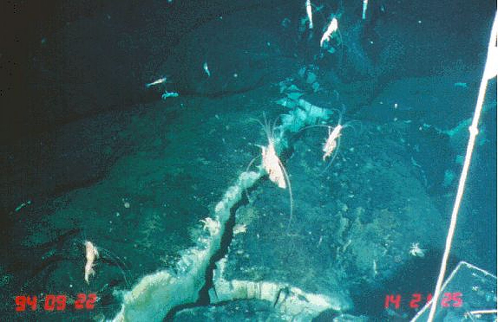
Lava flows from a very recent eruption were observed in 1994 along segment K of the southern East Pacific Rise. This segment of the mid-ocean ridge north of the Easter microplate displays the broadest cross-sectional area and the shallowest depth (2,566 m) of the southern East Pacific Rise between 13°40' and 18°30'S. Glassy, unsedimented lava flows on the 17.5°S segment of the East Pacific Rise were considered, from biological observations and chemical analyses of the plume and vent fluids, to have been erupted within 2-3 years of a November-December 1993 plume survey. Lava was erupted along two segments, a 4-km-long flow at the southern site and a 5-10 km flow at the northern site. Numerous low- and high-temperature hydrothermal vents are active along this segment of the ridge.
분화 이력
5건 기록용어집상세 타임라인
- 1990년 (±2년)VEI 0관측 기록1990-07-02 ~ 종료일 미상
- 1965년VEI 0지질학적 추정1965-07-02 ~ 종료일 미상South of Aldo-Kihi lava flow
- 1930년VEI 0지질학적 추정1930-07-02 ~ 종료일 미상North of Aldo-Kiri lava flow
- 1840년VEI 0지질학적 추정1840-07-02 ~ 종료일 미상North of Aldo-Kiri lava flow
- 1625년VEI 0지질학적 추정1625 ~ 종료일 미상South of Aldo-Kihi lava flow
주변 화산
외부 링크
- 한국어 Wikipedia에 아직 기사가 없습니다. Wikidata에서 작성할 수 있습니다.
- Smithsonian GVP 원본 페이지
⚠ 참고용 정보입니다. 재난 대응에 사용하지 마세요.