멕시코 · 화산군
Sierra Chichinautzin
Chichinautzin
- 화산 유형
- 화산군
- 해발
- 3938m
- 마지막 분화
- 399년
- 화산 유형
- 화산군
- 국가
- 멕시코
- 지역
- 중앙아메리카·카리브해 / Trans-Mexican Volcanic Arc
- 해발
- 3938m
- 좌표
- 19.139, -99.160
- 마지막 분화
- 399년
- 판구조 환경
- 섭입대 / 대륙 지각 (> 25 km)
- 화산 지형
- 화산군
- 주요 암석
- 안산암 / 현무암질 안산암
지질학적 요약
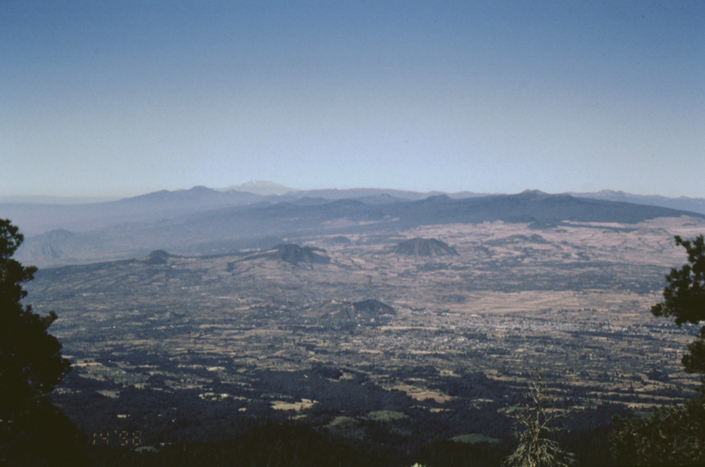
The massive Chichinautzin volcanic field extends over an 88 km E-W area immediately south of Mexico City. The Sierra Chichinautzin, formed primarily of overlapping small cinder cones and shield volcanoes, creates a broad topographic barrier at the southern end of the Basin of Mexico that extends from the E flank of Nevado de Toluca to the W flank of Iztaccíhuatl. The volcanic field contains more than 220 Pleistocene-to-Holocene monogenetic vents. The best-known eruption occurred about 1,670 radiocarbon years ago (400 CE) from the Xitle scoria cone, NE of the Volcán Ajusco lava dome complex, which forms the highest peak of the Sierra Chichinautzin. The Xitle eruption produced a massive basaltic tube-fed lava flow that covered agricultural lands as well as pyramids and other structures of Cuicuilco and adjacent prehispanic urban centers. The southern part of Mexico City and the National University of México lie atop the distal end of the 13-km-long lava flow.
Wikipedia 요약
영어 요약The Sierra Chichinautzin volcanic field, also known as El Pedegral, is located in the Trans-Mexican Volcanic Belt, approximately 350 kilometres (220 mi) from where the Cocos Plate subducts beneath the North American Plate.
Wikipedia · CC BY-SA · 전체 기사 보기 →
분화 이력
8건 기록용어집상세 타임라인
- 399년 (±149년)VEI 3지질학적 추정399 ~ 종료일 미상Xitle
- 203년 (±131년)VEI 3지질학적 추정203 ~ 종료일 미상Chichinautzin
- 기원전 2238년 (±1413년)VEI 3지질학적 추정기원전 2238 ~ 종료일 미상Guespalapa
- 기원전 4250년 (±75년)VEI 3지질학적 추정기원전 4250 ~ 종료일 미상Tláloc
- 기원전 5840년 (±500년)VEI ?지질학적 추정기원전 5840 ~ 종료일 미상Cuauhtzin
- 기원전 7340년 (±1050년)VEI 0지질학적 추정기원전 7340 ~ 종료일 미상Cerro Tetepetl
- 기원전 7370년 (±300년)VEI 4지질학적 추정기원전 7370 ~ 종료일 미상Tres Cruces
- 기원전 7930년 (±500년)VEI 3지질학적 추정기원전 7930 ~ 종료일 미상Volcán Pelado
주변 화산
외부 링크
⚠ 참고용 정보입니다. 재난 대응에 사용하지 마세요.