Rusia · Maar
Kinenin
- Tipe
- Maar
- Ketinggian
- 583 m
- Letusan terakhir
- 850
- Tipe
- Maar
- Negara
- Rusia
- Wilayah
- Pasifik Barat Laut / Central Kamchatka Volcanic Arc
- Ketinggian
- 583 m
- Koordinat
- 57.350, 160.970
- Letusan terakhir
- 850
- Kondisi tektonik
- Zona subduksi / Kerak benua (> 25 km)
- Bentuk lahan
- Kecil
- Batuan utama
- Basal / Pikrobasal
Ringkasan geologi
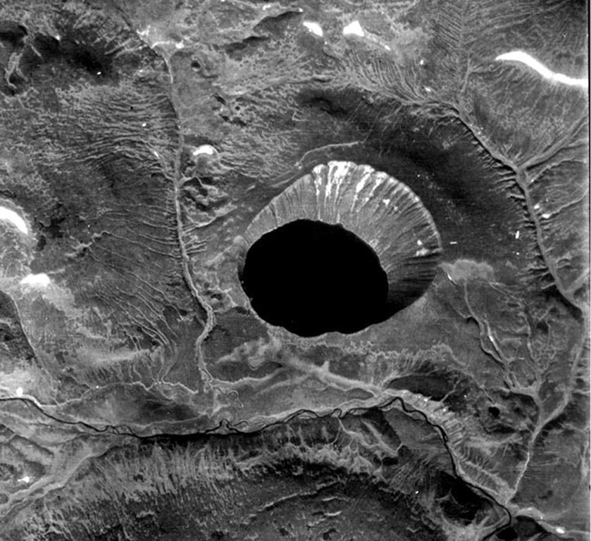
Kinenin maar lies at the eastern foot of the Sredinny Range, about 80 km NNW of Sheveluch volcano. The 2.5-km-wide, funnel-shaped maar was formed along the Kinenin River, a tributary of the Elovka. It is partially filled by a 1-km-wide lake whose surface is at 400 m elevation. The eastern rim at about 580 m is the high point of the crater. The eruption of Kinenin took place about 1,100 years ago, making it the youngest known maar in Kamchatka. Both silicic pyroclastic flows and mafic pyroclastic ejecta were produced, which were distributed primarily to the ENE. The location is north of the active Kamchatka subduction zone.
Riwayat letusan
1 tercatatGlosariumRingkasan (VEI dari waktu ke waktu)
Klik pada bar untuk melihat letusan individu · Gunakan tombol panah untuk berpindah batang, Enter untuk membuka
Garis waktu rinci
- 850 (±50 tahun)VEI 4Perkiraan geologi850 – akhir tidak diketahui
Gunung api terdekat
Tautan eksternal
- Belum ada di Wikipedia (Bahasa Indonesia). Anda dapat berkontribusi di Wikidata.
- Halaman asli Smithsonian GVP
⚠ Untuk referensi saja. Bukan untuk tanggap darurat.