Kanada · Rekahan erupsi
Endeavour Segment
- Tipe
- Rekahan erupsi
- Ketinggian
- 2050 m (bawah laut)
- Letusan terakhir
- -3490
- Tipe
- Rekahan erupsi
- Negara
- Kanada
- Wilayah
- Pasifik Timur / Northeast Pacific Rifts Volcanic Province
- Ketinggian
- 2050 m (bawah laut)
- Koordinat
- 47.950, -129.100
- Letusan terakhir
- -3490
- Kondisi tektonik
- Zona rift / Kerak samudra (< 15 km)
- Bentuk lahan
- Gugusan gunung api
- Batuan utama
- Basal / Pikrobasal
Ringkasan geologi
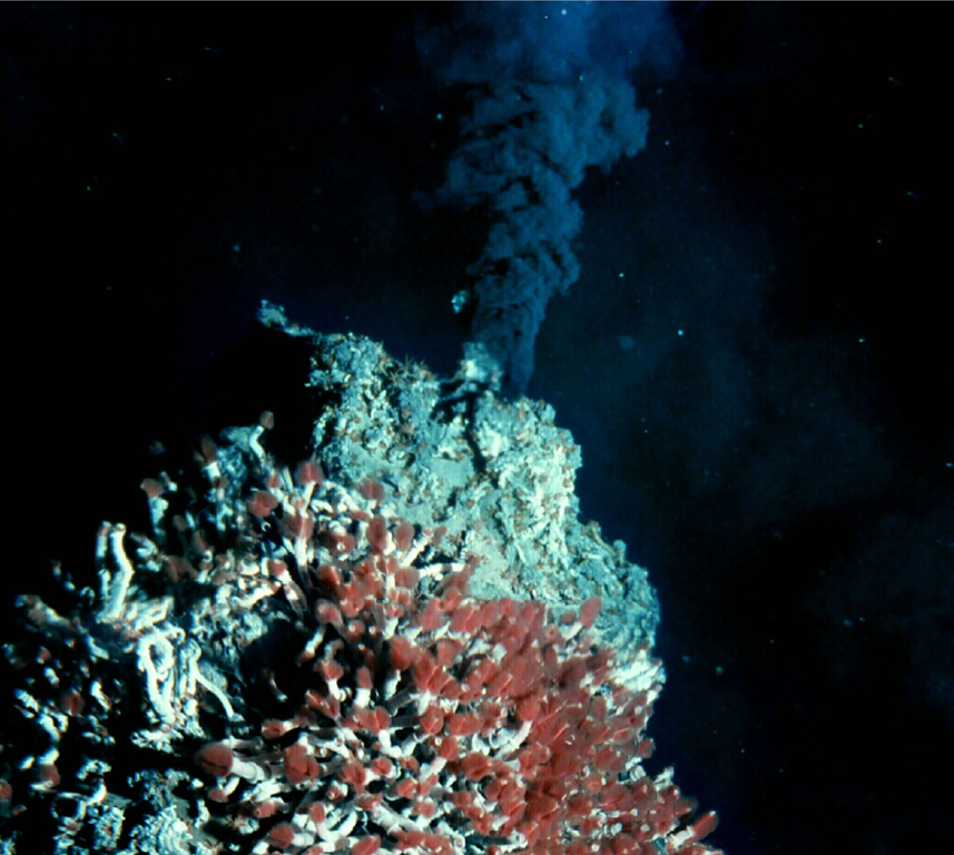
The Endeavour Segment (or Ridge) lies near the northern end of the Juan de Fuca Ridge, W of the coast of Washington and SW of Vancouver Island. The northern end is offset to the east with respect to the West Valley Segment, which extends north to the triple junction with the Sovanco Fracture Zone and the Nootka Fault. The 90-km-long, NNE-SSW-trending segment lies at a depth of more than 2,000 m and is the site of vigorous high-temperature hydrothermal vent systems that were discovered in 1981. Five major vent fields that include sulfide chimneys and black smoker vents are spaced at about 2-km intervals in a 1-km-wide axial valley at the center of the ridge. Preliminary uranium-series dates of Holocene age were obtained on basaltic lava flows, and other younger "zero-age" flows were sampled. Seismic swarms were detected in 1991 and 2005.
Riwayat letusan
2 tercatatGlosariumGaris waktu rinci
- 3490 SMVEI 0Perkiraan geologi3490 SM – akhir tidak diketahui
- 6930 SMVEI 0Perkiraan geologi6930 SM – akhir tidak diketahui
Gunung api terdekat
Tautan eksternal
- Belum ada di Wikipedia (Bahasa Indonesia). Anda dapat berkontribusi di Wikidata.
- Halaman asli Smithsonian GVP
⚠ Untuk referensi saja. Bukan untuk tanggap darurat.