Fitur bawah laut · Rekahan erupsi
CoAxial Segment
- Tipe
- Rekahan erupsi
- Ketinggian
- 2400 m (bawah laut)
- Letusan terakhir
- 1993
- Tipe
- Rekahan erupsi
- Negara
- Fitur bawah laut
- Wilayah
- Pasifik Timur / Northeast Pacific Rifts Volcanic Province
- Ketinggian
- 2400 m (bawah laut)
- Koordinat
- 46.520, -129.580
- Letusan terakhir
- 1993
- Kondisi tektonik
- Zona rift / Kerak samudra (< 15 km)
- Bentuk lahan
- Gugusan gunung api
- Batuan utama
- Basal / Pikrobasal
Ringkasan geologi
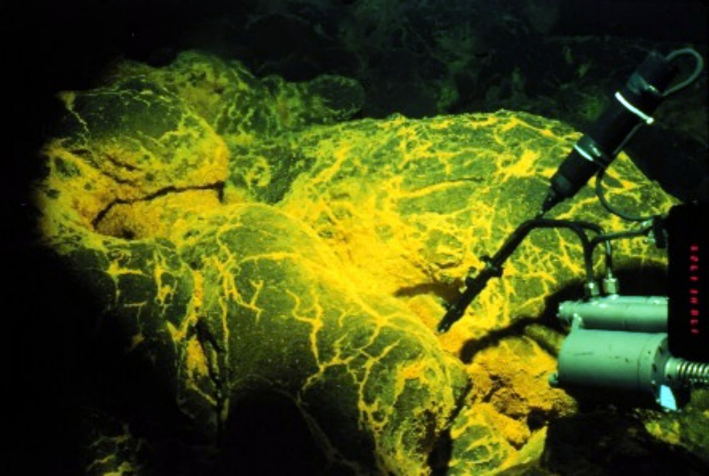
The CoAxial segment of the Juan de Fuca Ridge is about 435 km W of the Oregon coast, NE of Axial volcano. A submarine eruption along the CoAxial segment that produced thermal plumes and a new lava flow was detected by acoustic hydrophones in June 1993, just days after installation of the hydrophone system. This was the first deep-sea volcanic eruption detected as it was happening. The location of the eruption was at a depth of about 2,400 m, about 37 km NE of Axial volcano. Bathymetric surveys indicated that one or more additional sea-floor lava extrusions took place immediately east of the 1993 lava flow sometime between 1981-82 and 1991.
Riwayat letusan
2 tercatatGlosariumRingkasan (VEI dari waktu ke waktu)
Klik pada bar untuk melihat letusan individu · Gunakan tombol panah untuk berpindah batang, Enter untuk membuka
Garis waktu rinci
- 1993VEI 0Teramati1993-06-26 – 1993-07-04N end CoAxial segment, Juan de Fuca Ridge
- 1986 (±5 tahun)VEI 0Teramati1986-07-02 – akhir tidak diketahuiCoAxial segment, Juan de Fuca Ridge
Gunung api terdekat
Tautan eksternal
- Belum ada di Wikipedia (Bahasa Indonesia). Anda dapat berkontribusi di Wikidata.
- Halaman asli Smithsonian GVP
⚠ Untuk referensi saja. Bukan untuk tanggap darurat.