Amerika Serikat · Rekahan erupsi
Escanaba Segment
- Tipe
- Rekahan erupsi
- Ketinggian
- 1700 m (bawah laut)
- Letusan terakhir
- -2260
- Tipe
- Rekahan erupsi
- Negara
- Amerika Serikat
- Wilayah
- Pasifik Timur / Northeast Pacific Rifts Volcanic Province
- Ketinggian
- 1700 m (bawah laut)
- Koordinat
- 40.980, -127.500
- Letusan terakhir
- -2260
- Kondisi tektonik
- Zona rift / Kerak samudra (< 15 km)
- Bentuk lahan
- Gugusan gunung api
- Batuan utama
- Basal / Pikrobasal
Ringkasan geologi
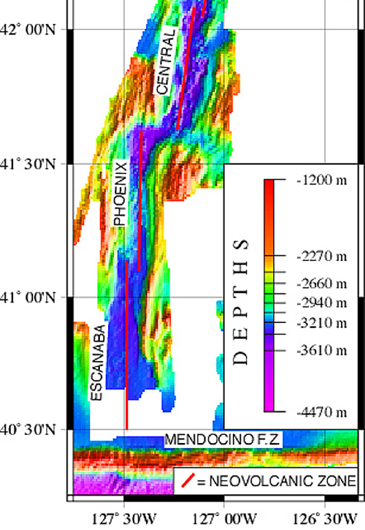
The linear, N-S-trending Escanaba Segment, the southernmost of the Gorda Ridge, lies immediately north of the Mendocino Fracture Zone off the coast of northern California. The axial crest of the 130-km-long segment, also known as the Escanaba Trough, is about 3-5 km wide at the northern end and increases to 18 km to the south near the junction with the Mendocino FZ. The rift valley floor of the slow-spreading segment lies at about 3,200 m depth, bounded by faulted walls about 1,500 m high with unusual gold-bearing massive sulfide deposits in sediment hills at the base of the scarps uplifted by volcanic sills or laccoliths. Thick sediment deposits from the continental margin enter the axial trough from the fracture zone and thin to the north. A preliminary uranium-series date of Holocene age was obtained from a basaltic lava flow in the axial valley in the less-sedimented northern part.
Riwayat letusan
1 tercatatGlosariumGaris waktu rinci
- 2260 SMVEI 0Perkiraan geologi2260 SM – akhir tidak diketahui40 deg 59 min North
Gunung api terdekat
Tautan eksternal
- Belum ada di Wikipedia (Bahasa Indonesia). Anda dapat berkontribusi di Wikidata.
- Halaman asli Smithsonian GVP
⚠ Untuk referensi saja. Bukan untuk tanggap darurat.