Islandia · Gunung api perisai
Þeistareykir
Theistareykir
- Tipe
- Gunung api perisai
- Ketinggian
- 563 m
- Letusan terakhir
- -900
- Tipe
- Gunung api perisai
- Negara
- Islandia
- Wilayah
- Samudra Atlantik / Iceland Neovolcanic Rift Volcanic Province
- Ketinggian
- 563 m
- Koordinat
- 65.883, -16.967
- Letusan terakhir
- -900
- Kondisi tektonik
- Zona rift / Kerak samudra (< 15 km)
- Bentuk lahan
- Perisai
- Batuan utama
- Basal / Pikrobasal
Ringkasan geologi
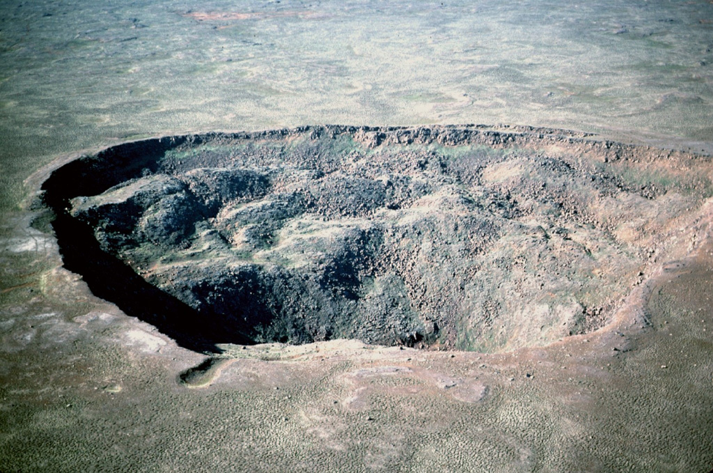
Teks asli bahasa InggrisThe Holocene Theistareykir fissure system, including the basaltic Theistareykjarbunga shield volcano, extends from north of Myvatn lake to the coast of Iceland.
Kutipan dari Global Volcanism Program, Smithsonian Institution · Baca ringkasan lengkap di GVP →
Riwayat letusan
3 tercatatGlosariumRingkasan catatan
- Letusan terkonfirmasi
- 3
- Letusan tidak pasti
- 0
- Rentang catatan terkonfirmasi
- 9500 SM – 900 SM
- Letusan terkonfirmasi terbesar
- VEI 0 (900 SM, yang terbaru dari 3)
- Letusan terkonfirmasi sejak 1900
- 0
Ringkasan (VEI dari waktu ke waktu)
Klik pada bar untuk melihat letusan individu · Gunakan tombol panah untuk berpindah batang, Enter untuk membuka
Garis waktu rinci
- 900 SM (±100 tahun)VEI 0Perkiraan geologi900 SM – akhir tidak diketahuiStorihver (Theistareykjahraun)
- 6800 SMVEI 0Perkiraan geologi6800 SM – akhir tidak diketahuiBorgarhraun and other flows
- 9500 SMVEI 0Perkiraan geologi9500 SM – akhir tidak diketahuiTheistareykjabunga shield volcano
Gunung api terdekat
Tautan eksternal
- Belum ada di Wikipedia (Bahasa Indonesia). Anda dapat berkontribusi di Wikidata.
- Halaman asli Smithsonian GVP
⚠ Untuk referensi saja. Bukan untuk tanggap darurat.