本文へスキップ
地図に戻る
比較地図で見る

エチオピア · 割れ目火口

East Zway

East Ziway

タイプ
割れ目火口
標高
1889m
最終噴火
不明
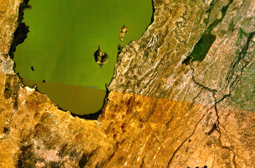
A large area of Holocene cinder cones and lava flows lies immediately east and south of Zway Lake (bottom) and forms islands along its eastern shore in this NASA Landsat mosaic (with north to the top). Faulting along the East Zway segment of the Wonji Fault Belt is seen cutting horizontally across the bottom of the image. The dark-colored Alutu volcanic complex lies the lower left. The 15 x 30 km wide Zway (also spelled Zwai, Zeway, or Ziway) lake occupies the central Ethiopian Rift.
A large area of Holocene cinder cones and lava flows lies immediately east and south of Zway Lake (bottom) and forms islands along its eastern shore in this NASA Landsat mosaic (with north to the top). Faulting along the East Zway segment of the Wonji Fault Belt is seen cutting horizontally across the bottom of the image. The dark-colored Alutu volcanic complex lies the lower left. The 15 x 30 km wide Zway (also spelled Zwai, Zeway, or Ziway) lake occupies the central Ethiopian Rift. · 写真: NASA Landsat 7 image (worldwind.arc.nasa.gov)
タイプ
割れ目火口
国
エチオピア
地域
東アフリカ / Main Ethiopian Rift Volcanic Province
標高
1889m
座標
7.874, 38.902
最終噴火
不明
テクトニクス環境
リフト帯 / 大陸地殻 (> 25 km)
火山地形
火山群
主要岩石
玄武岩 / ピクライト質玄武岩
地質学的概要

A large area of basaltic cinder cones and lava flows lies within about 5 km of the SE shore of Lake Ziway, and also forms islands along its E shore. About 80 vents were formed along the East Ziway segment of the Wonji Fault Belt. The youngest lava flows have been unaffected by the latest tectonic faulting along the Ethiopian Rift.

噴火履歴

用語集

詳細タイムライン

噴火記録はありません。

近くの火山

外部リンク

⚠ 参考情報です。緊急対応には使用しないでください。