本文へスキップ
地図に戻る
比較地図で見る

ケニア · 凝灰岩円錐丘

North Island

Lake Turkana North Island

タイプ
凝灰岩円錐丘
標高
490m
最終噴火
不明
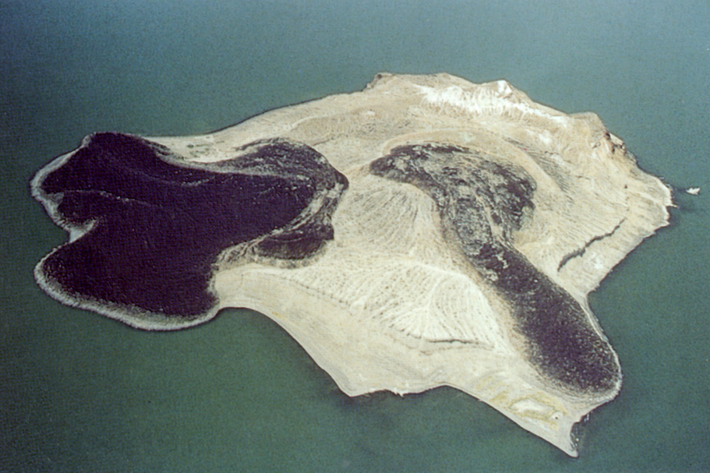
North Island in the north-central part of Lake Turkana is the northernmost and smallest of three volcanic islands in the lake. The two darker lava flows originated from a central tuff ring and formed lava deltas. The broad northern flow (left) originated from a vent on the flank and produced a 900-m-wide, lobate delta. The western flow (lower right) moved from the central vent through a breach in the western crater wall. Fumarolic activity occurs along the light-colored ridge at the top and along the SW coast.
North Island in the north-central part of Lake Turkana is the northernmost and smallest of three volcanic islands in the lake. The two darker lava flows originated from a central tuff ring and formed lava deltas. The broad northern flow (left) originated from a vent on the flank and produced a 900-m-wide, lobate delta. The western flow (lower right) moved from the central vent through a breach in the western crater wall. Fumarolic activity occurs along the light-colored ridge at the top and along the SW coast. · 写真: Photo by Martin Smith, 1993 (copyright British Geological Survey, NERC).
タイプ
凝灰岩円錐丘
国
ケニア
地域
東アフリカ / Kenyan Rift Volcanic Province
標高
490m
座標
4.063, 36.046
最終噴火
不明
テクトニクス環境
リフト帯 / 大陸地殻 (> 25 km)
火山地形
小規模 (玄武岩質)
主要岩石
粗面安山岩 / 玄武岩質粗面安山岩

地質学的概要

英語の原文

The 2-km-wide North Island in Lake Turkana is the northernmost and smallest of three volcanic islands in the lake.

出典:Global Volcanism Program, Smithsonian Institution(抜粋) · GVP で全文を読む →

噴火履歴

用語集

詳細タイムライン

噴火記録はありません。

近くの火山

外部リンク

⚠ 参考情報です。緊急対応には使用しないでください。