ケニア · 楯状火山
バリアー山
Barrier, The
- タイプ
- 楯状火山
- 標高
- 1032m
- 最終噴火
- 1921年
- タイプ
- 楯状火山
- 国
- ケニア
- 地域
- 東アフリカ / Kenyan Rift Volcanic Province
- 標高
- 1032m
- 座標
- 2.320, 36.570
- 最終噴火
- 1921年
- テクトニクス環境
- リフト帯 / 大陸地殻 (> 25 km)
- 火山地形
- 楯状火山
- 主要岩石
- 粗面岩 / 粗面デイサイト
地質学的概要
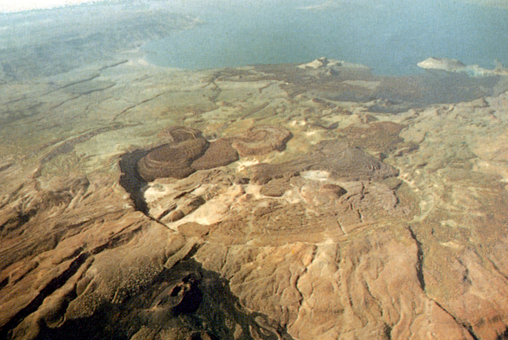
The Barrier volcanic complex separates Lake Turkana from the broad Suguta Trough to the S, the site of a former lake. The volcano is comprised of four overlapping shield volcanoes, with the youngest, Kakorinya, located over the axis of the East African Rift. Kalolenyang volcano lies W of Kakorinya, and Likaiu West and Likaiu East are located to the ENE. A 3.8-km-wide summit caldera was formed at Kakorinya about 92,000 years ago. Youthful-looking trachytic and phonolitic lava domes and flows erupted within the caldera and along its ring fracture fill much of the caldera floor. Early Holocene fissure-related scoria cones and lava flows dot the S and N flanks. Solfataric fields are located within the caldera and on the W and S flanks. Historical eruptions from Teleki's and Andrew's cones on the N and S flanks, respectively, have produced basaltic explosive activity and lava flows during the 19th and 20th centuries.
噴火履歴
12件の記録用語集詳細タイムライン
- 1921年VEI 2観測記録1921-12-31 ~ 終了日不明North flank (Teleki)
- 1920年 (±3年)VEI ?根拠の記載なし1920-07-02 ~ 終了日不明South flank (Andrew's Volcano)
- 1917年VEI 2観測記録1917-07-02 ~ 終了日不明Andrew's or Teleki's Volcanoes
- 1906年VEI ?根拠の記載なし1906-07-02 ~ 終了日不明Andrew's or Teleki's Cones
- 1897年VEI 2観測記録1897-05-16 ~ 終了日不明North flank (Teleki) and Likaiu
- 1895年VEI 2観測記録1895-07-02 ~ 終了日不明North flank (Teleki's Cone)
- 1888年VEI 0観測記録1888-07-02 ~ 終了日不明North flank (Teleki's Cone)
- 1871年 (±3年)VEI 2観測記録1871-07-02 ~ 終了日不明North flank (Teleki's Cone)
- 1090年 (±50年)VEI 0地質学的推定1090 ~ 終了日不明North flank
- 1050年 (±150年)VEI 0地質学的推定1050 ~ 終了日不明North flank
- 1030年 (±150年)VEI 0地質学的推定1030 ~ 終了日不明North flank
- 紀元前 7710年 (±200年)VEI ?地質学的推定紀元前 7710 ~ 終了日不明North (Abili Agituk) and south flanks
近くの火山
外部リンク
⚠ 参考情報です。緊急対応には使用しないでください。