本文へスキップ
地図に戻る
比較地図で見る

ニュージーランド · 成層火山

Rumble V Seamount

Rumble V

タイプ
成層火山
標高
400m (海底)
最終噴火
不明
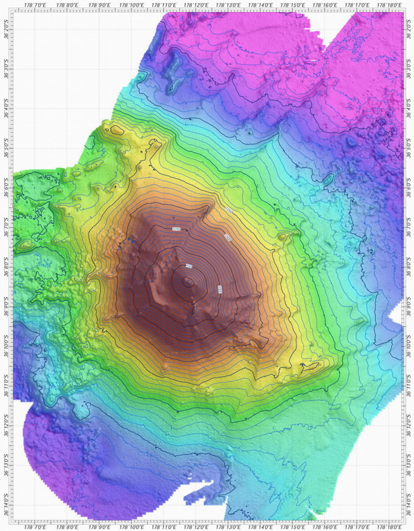
A bathymetric map view shows Rumble V submarine volcano at the southern end of the South Kermadec volcano group. A large plume of gas bubbles was acoustically detected rising from the summit in 1992. Rumble V, the southernmost of a group of seamounts on the southern Kermadec Ridge known as the Rumbles, rises more than 2,000 m to about 400 m below the sea surface.
A bathymetric map view shows Rumble V submarine volcano at the southern end of the South Kermadec volcano group. A large plume of gas bubbles was acoustically detected rising from the summit in 1992. Rumble V, the southernmost of a group of seamounts on the southern Kermadec Ridge known as the Rumbles, rises more than 2,000 m to about 400 m below the sea surface. · 写真: Courtesy of Ian Wright (National Institute of Water and Atmospheric Research (NIWA), Wellington, New Zealand).
タイプ
成層火山
国
ニュージーランド
地域
トンガ・ケルマデック / Southern Kermadec Volcanic Arc
標高
400m (海底)
座標
-36.142, 178.196
最終噴火
不明
テクトニクス環境
沈み込み帯 / 海洋地殻 (< 15 km)
火山地形
複成火山
主要岩石
安山岩 / 玄武岩質安山岩

地質学的概要

英語の原文

Rumble V was discovered in 1992 at the southernmost end of the Rumble seamounts on the southern Kermadec Ridge, 17 km ESE of Rumble IV.

出典:Global Volcanism Program, Smithsonian Institution(抜粋) · GVP で全文を読む →

噴火履歴

用語集

詳細タイムライン

噴火記録はありません。

近くの火山

外部リンク

⚠ 参考情報です。緊急対応には使用しないでください。