本文へスキップ
地図に戻る
比較地図で見る

ニュージーランド · 成層火山

Rumble II West Seamount

Rumble II West

タイプ
成層火山
標高
1200m (海底)
最終噴火
不明
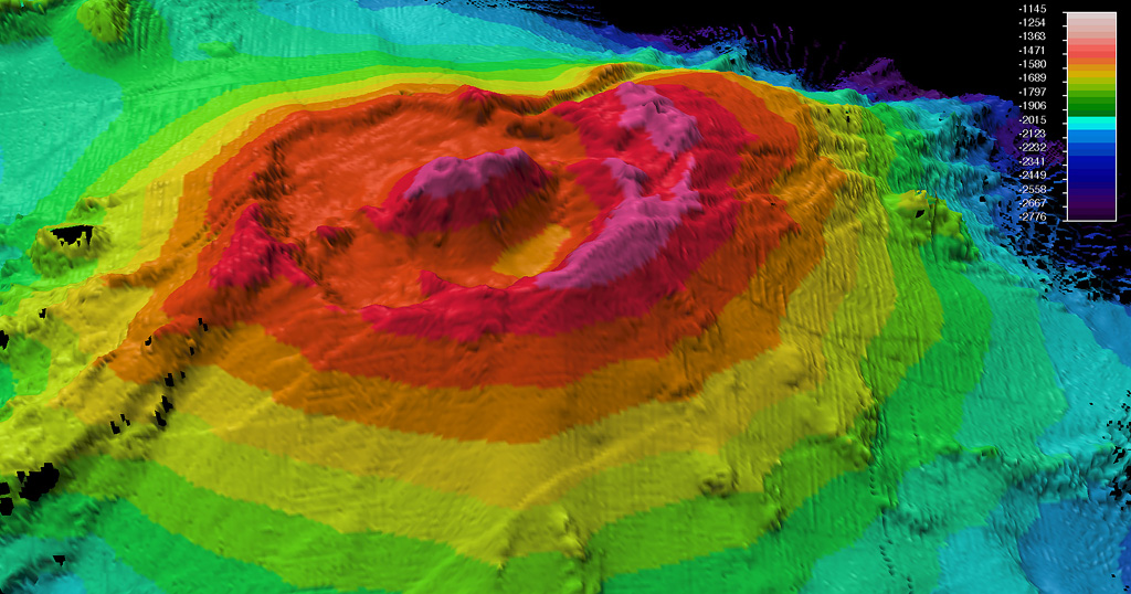
A bathymetric map was made during a 2009 voyage on the research vessel R/V Thompson of Rumble II West submarine volcano. Located NW of Rumble II East, Rumble II West, with a summit depth of 1,200 m, is the deepest of the Rumble group of seamounts, but displays evidence of hydrothermal activity. It contains a 2.5-3 km wide summit caldera about 200 m deep with a central cone. Recent lava flows originating from near the caldera rim with little or no sediment cover are on the S flanks.
A bathymetric map was made during a 2009 voyage on the research vessel R/V Thompson of Rumble II West submarine volcano. Located NW of Rumble II East, Rumble II West, with a summit depth of 1,200 m, is the deepest of the Rumble group of seamounts, but displays evidence of hydrothermal activity. It contains a 2.5-3 km wide summit caldera about 200 m deep with a central cone. Recent lava flows originating from near the caldera rim with little or no sediment cover are on the S flanks. · 写真: Photo courtesy of New Zealand Institute of Geology and Nuclear Sciences, 2009.
タイプ
成層火山
国
ニュージーランド
地域
トンガ・ケルマデック / Southern Kermadec Volcanic Arc
標高
1200m (海底)
座標
-35.353, 178.527
最終噴火
不明
テクトニクス環境
沈み込み帯 / 海洋地殻 (< 15 km)
火山地形
複成火山
主要岩石
安山岩 / 玄武岩質安山岩
地質学的概要

Rumble II West, about 12 km NW of Rumble II East, rises 1,800 m from the ocean floor to within 1,200 m of the surface. Bathymetry shows a 2.5-3 km summit caldera about 200 m deep with a central cone. There is evidence of hydrothermal activity, and cones are present on the flanks. Some lava flows on the western flanks originating from near the caldera rim have little or no sediment cover.

噴火履歴

用語集

詳細タイムライン

噴火記録はありません。

近くの火山

外部リンク

⚠ 参考情報です。緊急対応には使用しないでください。