ロシア · 火砕丘
Veer
- タイプ
- 火砕丘
- 標高
- 520m
- 最終噴火
- 390年
- タイプ
- 火砕丘
- 国
- ロシア
- 地域
- 北西太平洋 / Eastern Kamchatka Volcanic Arc
- 標高
- 520m
- 座標
- 53.752, 158.448
- 最終噴火
- 390年
- テクトニクス環境
- 沈み込み帯 / 大陸地殻 (> 25 km)
- 火山地形
- 小規模 (玄武岩質)
- 主要岩石
- 玄武岩 / ピクライト質玄武岩
地質学的概要
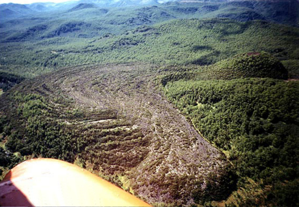
Cinder cones along the Levaya Avacha River about 60 km N of Petropavlovsk-Kamchatskiy erupted lavas over young river terraces. The basaltic Veer cone, located on the W side of the river, produced a lava flow with prominent ridges that descended into the valley. Although Krijanovsky (1934) listed an 1856 eruption, stratigraphic studies have shown that the eruption occurred sometime between the 1,500 years before present (BP) eruption from Barany Amphitheater of Opala volcano and a 1,630 BP eruption from Avachinsky (Dirksen, 1999 pers. comm.). Nearby andesitic Pravy volcano is also of postglacial age.
噴火履歴
1件の記録用語集概要 (VEI時系列)
バーをクリックすると個別の噴火が表示されます · 矢印キーで棒を移動、Enterで表示
詳細タイムライン
- 390年 (±75年)VEI 2地質学的推定390 ~ 終了日不明
近くの火山
外部リンク
- 日本語版Wikipediaには未登録です。Wikidataで作成できます。
- Smithsonian GVP 原典ページ
⚠ 参考情報です。緊急対応には使用しないでください。