ロシア · マール
Kinenin
- タイプ
- マール
- 標高
- 583m
- 最終噴火
- 850年
- タイプ
- マール
- 国
- ロシア
- 地域
- 北西太平洋 / Central Kamchatka Volcanic Arc
- 標高
- 583m
- 座標
- 57.350, 160.970
- 最終噴火
- 850年
- テクトニクス環境
- 沈み込み帯 / 大陸地殻 (> 25 km)
- 火山地形
- 小規模
- 主要岩石
- 玄武岩 / ピクライト質玄武岩
地質学的概要
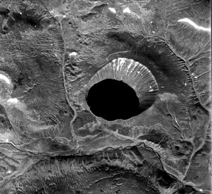
Kinenin maar lies at the eastern foot of the Sredinny Range, about 80 km NNW of Sheveluch volcano. The 2.5-km-wide, funnel-shaped maar was formed along the Kinenin River, a tributary of the Elovka. It is partially filled by a 1-km-wide lake whose surface is at 400 m elevation. The eastern rim at about 580 m is the high point of the crater. The eruption of Kinenin took place about 1,100 years ago, making it the youngest known maar in Kamchatka. Both silicic pyroclastic flows and mafic pyroclastic ejecta were produced, which were distributed primarily to the ENE. The location is north of the active Kamchatka subduction zone.
噴火履歴
1件の記録用語集概要 (VEI時系列)
バーをクリックすると個別の噴火が表示されます · 矢印キーで棒を移動、Enterで表示
詳細タイムライン
- 850年 (±50年)VEI 4地質学的推定850 ~ 終了日不明
近くの火山
外部リンク
- 日本語版Wikipediaには未登録です。Wikidataで作成できます。
- Smithsonian GVP 原典ページ
⚠ 参考情報です。緊急対応には使用しないでください。