メキシコ · 火山原
Sierra Chichinautzin
Chichinautzin
- タイプ
- 火山原
- 標高
- 3938m
- 最終噴火
- 399年
- タイプ
- 火山原
- 国
- メキシコ
- 地域
- 中央アメリカ・カリブ海 / Trans-Mexican Volcanic Arc
- 標高
- 3938m
- 座標
- 19.139, -99.160
- 最終噴火
- 399年
- テクトニクス環境
- 沈み込み帯 / 大陸地殻 (> 25 km)
- 火山地形
- 火山群
- 主要岩石
- 安山岩 / 玄武岩質安山岩
地質学的概要
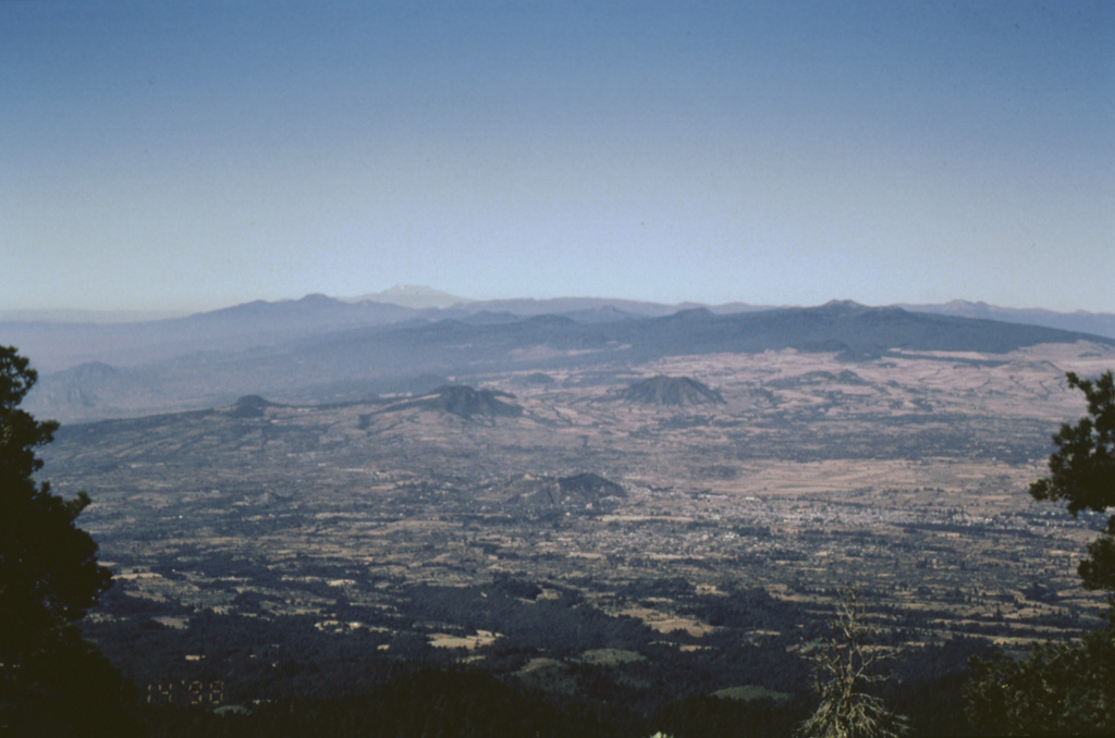
The massive Chichinautzin volcanic field extends over an 88 km E-W area immediately south of Mexico City. The Sierra Chichinautzin, formed primarily of overlapping small cinder cones and shield volcanoes, creates a broad topographic barrier at the southern end of the Basin of Mexico that extends from the E flank of Nevado de Toluca to the W flank of Iztaccíhuatl. The volcanic field contains more than 220 Pleistocene-to-Holocene monogenetic vents. The best-known eruption occurred about 1,670 radiocarbon years ago (400 CE) from the Xitle scoria cone, NE of the Volcán Ajusco lava dome complex, which forms the highest peak of the Sierra Chichinautzin. The Xitle eruption produced a massive basaltic tube-fed lava flow that covered agricultural lands as well as pyramids and other structures of Cuicuilco and adjacent prehispanic urban centers. The southern part of Mexico City and the National University of México lie atop the distal end of the 13-km-long lava flow.
Wikipedia の要約
英語版の要約The Sierra Chichinautzin volcanic field, also known as El Pedegral, is located in the Trans-Mexican Volcanic Belt, approximately 350 kilometres (220 mi) from where the Cocos Plate subducts beneath the North American Plate.
Wikipedia · CC BY-SA · 記事全文を読む →
噴火履歴
8件の記録用語集詳細タイムライン
- 399年 (±149年)VEI 3地質学的推定399 ~ 終了日不明Xitle
- 203年 (±131年)VEI 3地質学的推定203 ~ 終了日不明Chichinautzin
- 紀元前 2238年 (±1413年)VEI 3地質学的推定紀元前 2238 ~ 終了日不明Guespalapa
- 紀元前 4250年 (±75年)VEI 3地質学的推定紀元前 4250 ~ 終了日不明Tláloc
- 紀元前 5840年 (±500年)VEI ?地質学的推定紀元前 5840 ~ 終了日不明Cuauhtzin
- 紀元前 7340年 (±1050年)VEI 0地質学的推定紀元前 7340 ~ 終了日不明Cerro Tetepetl
- 紀元前 7370年 (±300年)VEI 4地質学的推定紀元前 7370 ~ 終了日不明Tres Cruces
- 紀元前 7930年 (±500年)VEI 3地質学的推定紀元前 7930 ~ 終了日不明Volcán Pelado
近くの火山
外部リンク
⚠ 参考情報です。緊急対応には使用しないでください。