アルゼンチン · 火山原
Crater Basalt Volcanic Field
- タイプ
- 火山原
- 標高
- 1344m
- 最終噴火
- 不明
- タイプ
- 火山原
- 国
- アルゼンチン
- 地域
- 南アメリカ / Southern Andean Volcanic Arc
- 標高
- 1344m
- 座標
- -42.018, -70.194
- 最終噴火
- 不明
- テクトニクス環境
- プレート内部 / 大陸地殻 (> 25 km)
- 火山地形
- 火山群
- 主要岩石
- 粗面玄武岩 / テフライト・バサナイト
地質学的概要
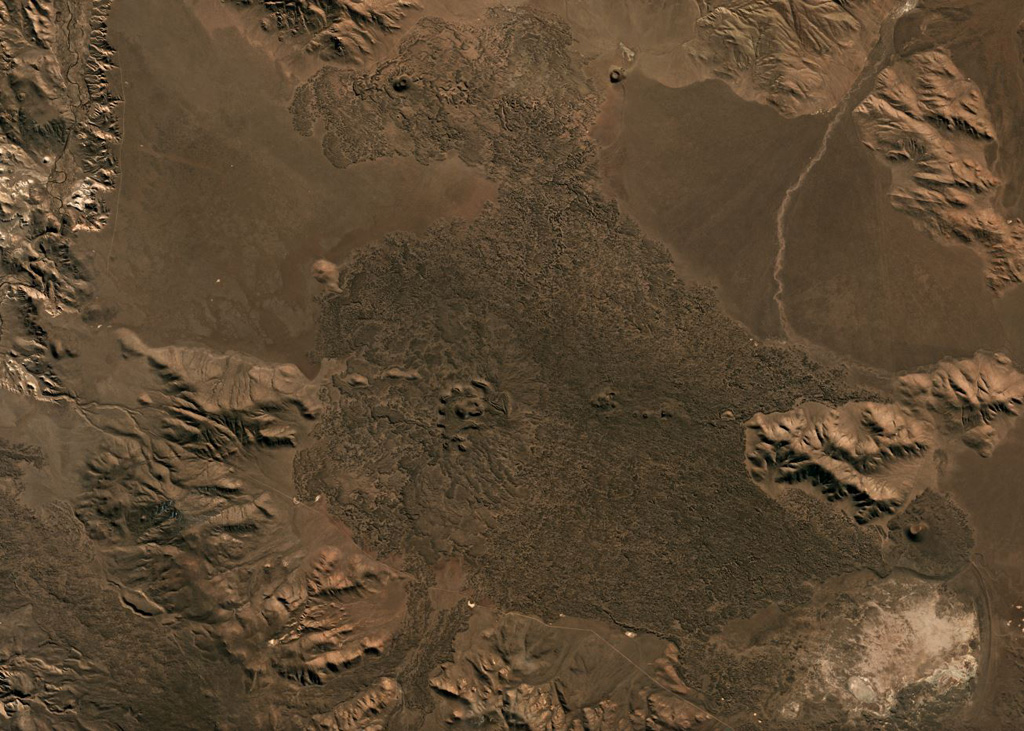
The Crater Basalt volcanic field in the northern Patagonia region of Argentina covers an area of about 700 km2. The field lies about 400 km E of the Peru-Chile trench along the broad regional Gastre fault system. Nine cinder cones and spatter cones produced blocky lava flows of alkali basaltic, basanitic, and trachybasaltic composition. One of the largest features is Cerro Fermín, a cinder cone that produced multiple lava flows. The highest cone, Cerro Negro, fed lava flows that traveled to the W, E, and then NE, where its distal margin is cut by a provincial road. Some of the lava flows, such as those from Cerro Ventana and Cerro Contreras, cover Holocene shorelines of playa lakes.
噴火履歴
用語集詳細タイムライン
噴火記録はありません。
近くの火山
外部リンク
- 日本語版Wikipediaには未登録です。Wikidataで作成できます。
- Smithsonian GVP 原典ページ
⚠ 参考情報です。緊急対応には使用しないでください。