중국 · 화산군
Wudalianchi
- 화산 유형
- 화산군
- 해발
- 597m
- 마지막 분화
- 1776년
- 화산 유형
- 화산군
- 국가
- 중국
- 지역
- 동아시아 / Central East Asia Volcanic Province
- 해발
- 597m
- 좌표
- 48.722, 126.150
- 마지막 분화
- 1776년
- 판구조 환경
- 판 내부 / 대륙 지각 (> 25 km)
- 화산 지형
- 화산군
- 주요 암석
- 조면현무암 / 테프라이트 바사나이트
지질학적 요약
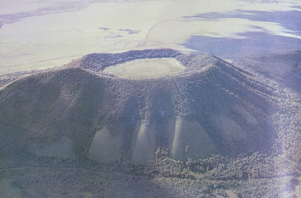
The Wudalianchi volcanic field, named for a string of five scenic lava-dammed lakes, consists of 14 cinder cones capping a 500 km2 shield-like lava plateau in NE China. The volcanic field, whose name means "Five Connected Pools" was formed during five eruptive cycles from the early Pleistocene to historical time. Its ancient name was "Nine Hills," which after the historical eruptions now number 14 hills. The cinder cones were erupted through basement sedimentary and granitic rocks and show a preferred alignment along three chains at the intersection of NE- and NW-trending lineaments. In addition to the historical cinder cones of Laoheishan and Huoshaoshan, Xilongmenshan and Donglongmenshan are Holocene in age. The freshly preserved cones of Laoheishan and Huoshaoshan were formed during eruptions in 1720-21. Fissures at the base of the two new cinder cones fed glassy pahoehoe and aa lava flows that covered 65 km2 and formed the five lakes of Wudalianchi at their eastern and northern margins. Renewed eruptions took place in 1776.
분화 이력
2건 기록용어집상세 타임라인
- 1776년VEI 2관측 기록1776 ~ 종료일 미상Laoheishan
- 1720년VEI 3관측 기록1720-01-14 ~ 1721-06Laoheishan and Huoshaoshan
주변 화산
외부 링크
- 한국어 Wikipedia에 아직 기사가 없습니다. Wikidata에서 작성할 수 있습니다.
- Smithsonian GVP 원본 페이지
⚠ 참고용 정보입니다. 재난 대응에 사용하지 마세요.