Papua New Guinea · Stratovolcano
Victory
- Type
- Stratovolcano
- Elevation
- 1832m
- Last eruption
- 1935
- Type
- Stratovolcano
- Country
- Papua New Guinea
- Region
- Southwestern Pacific / Trobriand Volcanic Province
- Elevation
- 1832m
- Coordinates
- -9.200, 149.072
- Last eruption
- 1935
- Tectonic setting
- Subduction zone / Continental crust (> 25 km)
- Landform
- Composite
- Major rock type
- Andesite / Basaltic andesite
Geological summary
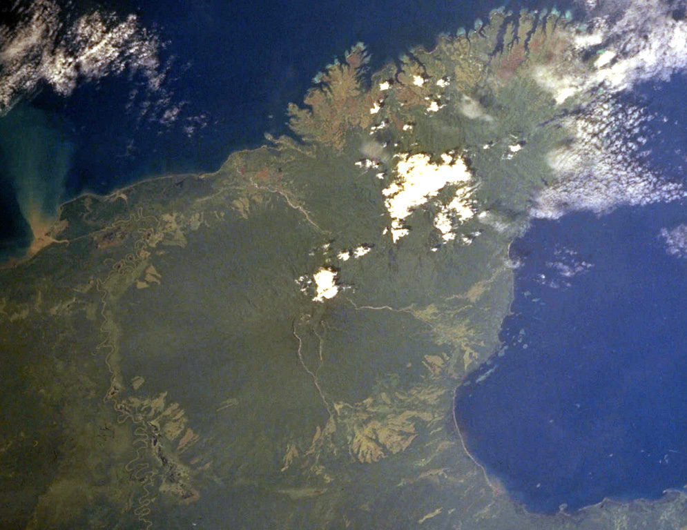
The dominantly andesitic Mount Victory stratovolcano, forming part of Cape Nelson on the NE coast of Papua New Guinea, is covered by rainforest.
Excerpt from the Global Volcanism Program, Smithsonian Institution · Read the full summary on GVP →
From Wikipedia
Summary of the Wikipedia article “Mount Victory (Papua New Guinea)”
Mount Victory is an active volcano on the north east coast of Oro Province, Papua New Guinea with an approximate height of 1,884 metres (6,181 ft) to 1,891 metres (6,204 ft). It is bounded by the Ajova River.
Wikipedia · CC BY-SA · Read full article →
Eruption history
2 recordedGlossaryRecord summary
- Confirmed eruptions
- 1
- Uncertain eruptions
- 1
- Span of confirmed record
- 1890 – 1935
- Largest confirmed eruption
- VEI 2 (1890)
- Confirmed eruptions since 1900
- 0
Summary (VEI over time)
Click a bar to see individual eruptions · Use arrow keys to move between bars, Enter to open
Detailed timeline
- 1890VEI 2Observed1890-07-02 – 1935-07-02
- 1810 (±10 yrs)VEI 2Method not stated1810-07-02 – end unknown
Nearby volcanoes
External links
⚠ For reference only. Not for emergency response.