United States · Fissure vent
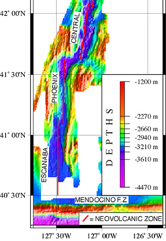
Escanaba Segment
- Type
- Fissure vent
- Elevation
- 1700m (submarine)
- Last eruption
- -2260
- Type
- Fissure vent
- Country
- United States
- Region
- Eastern Pacific / Northeast Pacific Rifts Volcanic Province
- Elevation
- 1700m (submarine)
- Coordinates
- 40.980, -127.500
- Last eruption
- -2260
- Tectonic setting
- Rift zone / Oceanic crust (< 15 km)
- Landform
- Cluster
- Major rock type
- Basalt / Picro-basalt
Geological summary
The linear, N-S-trending Escanaba Segment, the southernmost of the Gorda Ridge, lies immediately north of the Mendocino Fracture Zone off the coast of northern California. The axial crest of the 130-km-long segment, also known as the Escanaba Trough, is about 3-5 km wide at the northern end and increases to 18 km to the south near the junction with the Mendocino FZ. The rift valley floor of the slow-spreading segment lies at about 3,200 m depth, bounded by faulted walls about 1,500 m high with unusual gold-bearing massive sulfide deposits in sediment hills at the base of the scarps uplifted by volcanic sills or laccoliths. Thick sediment deposits from the continental margin enter the axial trough from the fracture zone and thin to the north. A preliminary uranium-series date of Holocene age was obtained from a basaltic lava flow in the axial valley in the less-sedimented northern part.
Eruption history
1 recordedGlossaryDetailed timeline
- 2260 BCEVEI 0Geological estimate2260 BCE – end unknown40 deg 59 min North
Nearby volcanoes
External links
- Not yet on Wikipedia (English). You can contribute on Wikidata.
- Smithsonian GVP source page
⚠ For reference only. Not for emergency response.