本文へスキップ
地図に戻る
比較地図で見る

ケニア · 楯状火山

Ol Kokwe

タイプ
楯状火山
標高
1130m
最終噴火
不明
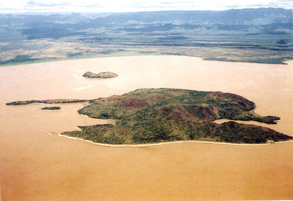
Ol Kokwe Island in Lake Baringo is seen in an aerial view looking W towards the Saimo escarpment of the rift margin. The elongated Island consists of young basaltic scoria cones that cap a trachytic shield volcano. N-S-trending faults cut the island, forming the double-tipped peninsula in the foreground and the narrow peninsula at the left center. The smaller island beyond Ol Kokwe is Parmalok, a tuff cone that fed a small lava flow.
Ol Kokwe Island in Lake Baringo is seen in an aerial view looking W towards the Saimo escarpment of the rift margin. The elongated Island consists of young basaltic scoria cones that cap a trachytic shield volcano. N-S-trending faults cut the island, forming the double-tipped peninsula in the foreground and the narrow peninsula at the left center. The smaller island beyond Ol Kokwe is Parmalok, a tuff cone that fed a small lava flow. · 写真: Photo by Martin Smith, 1993 (copyright British Geological Survey, NERC).
タイプ
楯状火山
国
ケニア
地域
東アフリカ / Kenyan Rift Volcanic Province
標高
1130m
座標
0.620, 36.075
最終噴火
不明
テクトニクス環境
リフト帯 / 大陸地殻 (> 25 km)
火山地形
楯状火山
主要岩石
玄武岩 / ピクライト質玄武岩

地質学的概要

英語の原文

The elongated Ol Kokwe Island in the center of Lake Baringo SW of Korosi volcano consists of young basaltic scoria cones that cap a trachytic shield volcano.

出典:Global Volcanism Program, Smithsonian Institution(抜粋) · GVP で全文を読む →

噴火履歴

用語集

詳細タイムライン

噴火記録はありません。

近くの火山

外部リンク

⚠ 参考情報です。緊急対応には使用しないでください。