本文へスキップ
地図に戻る
比較地図で見る

ケニア · 楯状火山

Nyambeni Hills

タイプ
楯状火山
標高
750m
最終噴火
不明
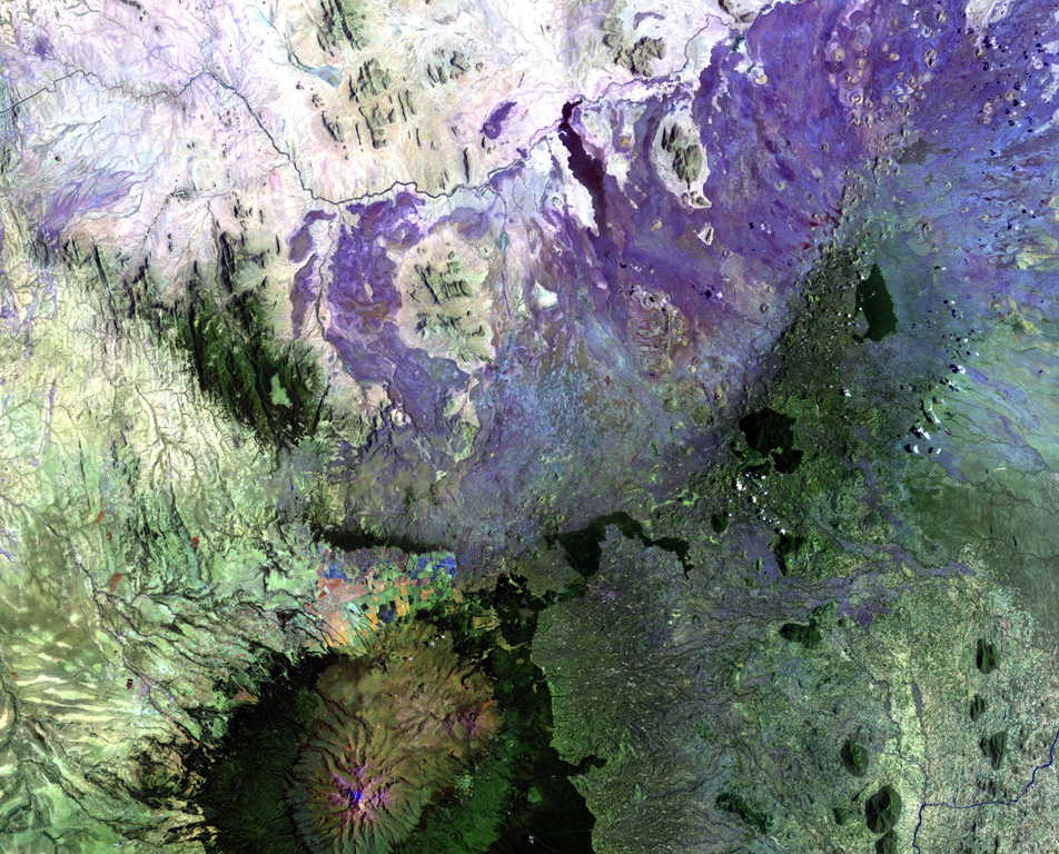
The broad NE-SW-trending Nyambeni Hills shield volcano cuts diagonally across this NASA Landsat image from the center to the upper right. It is located NE of the eroded Pleistocene Mount Kenya volcano (lower left) and is capped by numerous phonolitic lava domes and basaltic cones and lava flows. The basaltic scoria cones are the youngest features of Nyambeni Hills volcano and are clustered in a NE-trending belt along the crest of the shield and in N-S-trending areas on its flanks.
The broad NE-SW-trending Nyambeni Hills shield volcano cuts diagonally across this NASA Landsat image from the center to the upper right. It is located NE of the eroded Pleistocene Mount Kenya volcano (lower left) and is capped by numerous phonolitic lava domes and basaltic cones and lava flows. The basaltic scoria cones are the youngest features of Nyambeni Hills volcano and are clustered in a NE-trending belt along the crest of the shield and in N-S-trending areas on its flanks. · 写真: NASA Landsat image, 1999 (courtesy of Hawaii Synergy Project, Univ. of Hawaii Institute of Geophysics & Planetology).
タイプ
楯状火山
国
ケニア
地域
東アフリカ / Kenyan Rift Volcanic Province
標高
750m
座標
0.230, 37.870
最終噴火
不明
テクトニクス環境
リフト帯 / 大陸地殻 (> 25 km)
火山地形
楯状火山
主要岩石
玄武岩 / ピクライト質玄武岩
地質学的概要

The broad NE-SW-trending Nyambeni shield volcano is capped by numerous phonolitic lava domes, basaltic cones, and lava flows of late-Pleistocene to Holocene age (Hackman et al., 1989). The basaltic cinder cones are the youngest features. They are clustered in a NE-trending belt along the crest of the shield, in a N-S-trending area including the Mula Hills, and in the Giaki area.

噴火履歴

用語集

詳細タイムライン

噴火記録はありません。

近くの火山

外部リンク

⚠ 参考情報です。緊急対応には使用しないでください。