イエメン · 火山原
Harra of Arhab
Arhab, Harra of
- タイプ
- 火山原
- 標高
- 3100m
- 最終噴火
- 500年
- タイプ
- 火山原
- 国
- イエメン
- 地域
- アラビア・中央アジア / Southwest Arabia Volcanic Province
- 標高
- 3100m
- 座標
- 15.602, 44.098
- 最終噴火
- 500年
- テクトニクス環境
- プレート内部 / 大陸地殻 (> 25 km)
- 火山地形
- 火山群
- 主要岩石
- 粗面玄武岩 / テフライト・バサナイト
地質学的概要
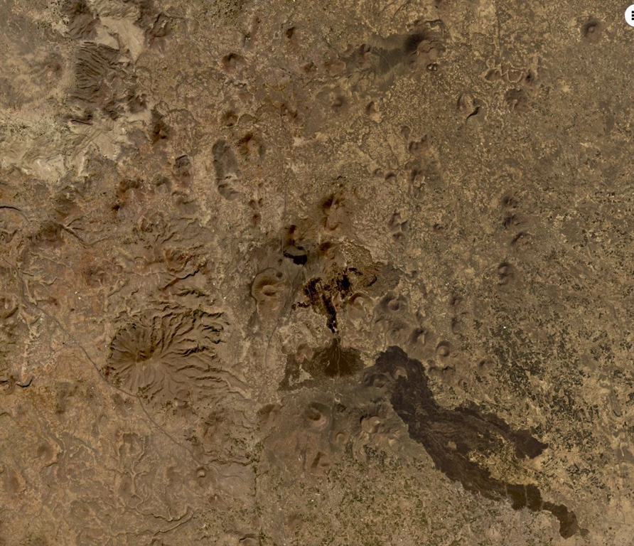
The Quaternary Harra of Arhab in Yemen, north of the capital city of Sana'a, consists of a 1,500 km2 basaltic plateau capped by a few small stratovolcanoes and about 60 scoria cones, two of which have erupted in historical time. Cones in the volcanic field (also known as the Sana'a or the Sana'a-Amran volcanic field) are commonly aligned along a NNW trend above a 100-250-m-thick volcanic plateau. Pliocene-to-Holocene volcanic rocks have a dominantly basaltic-to-hawaiitic composition and overlie the northern end of an area of extensive Oligocene-Miocene basaltic-to-rhyolitic rocks that extends to the SW tip of the Arabian Peninsula. Baker et al. (1997) include outcrops of Quaternary volcanism south of the main area of lava flows, such as Jabal al Marha, as part of this system, but note that they can be difficult to distinguish from Oligocene flood basalts. The latest eruption took place between about 400 and 600 CE and produced a lava flow that traveled 9 km.
Wikipedia の要約
英語版の要約The mainly Quaternary Harra of Arhab is the northernmost, historically active volcanic field in Yemen. Also known as the "Sana'a-'Amran volcanic field", or simply the "Sana'a volcanic field", it has erupted in ancient times.
Wikipedia · CC BY-SA · 記事全文を読む →
噴火履歴
2件の記録用語集詳細タイムライン
- 500年 (±100年)VEI 0観測記録500 ~ 終了日不明South flank of Kaulet Hattab
- 200年VEI 2地質学的推定200 ~ 終了日不明East flank of Jabal Zebib
近くの火山
外部リンク
⚠ 参考情報です。緊急対応には使用しないでください。