パプアニューギニア · 成層火山
Victory
- タイプ
- 成層火山
- 標高
- 1832m
- 最終噴火
- 1935年
- タイプ
- 成層火山
- 国
- パプアニューギニア
- 地域
- 南西太平洋 / Trobriand Volcanic Province
- 標高
- 1832m
- 座標
- -9.200, 149.072
- 最終噴火
- 1935年
- テクトニクス環境
- 沈み込み帯 / 大陸地殻 (> 25 km)
- 火山地形
- 複成火山
- 主要岩石
- 安山岩 / 玄武岩質安山岩
地質学的概要
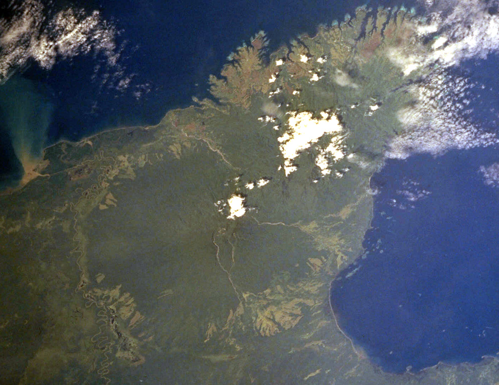
The dominantly andesitic Mount Victory stratovolcano, forming part of Cape Nelson on the NE coast of Papua New Guinea, is covered by rainforest. The deeply dissected Pleistocene Trafalgar volcano is immediately adjacent to the NE. The summit crater is breached to the SE, possibly due to landslides. Several lava domes are present in the summit area. Four small cones are located on the SW side, and two others occur on the NE flank. The only observed activity was a long-term late-19th to early 20th-century eruption that was frequently seen by passing ships. Pyroclastic flows have destroyed several villages and caused fatalities, and reached the coast.
Wikipedia の要約
英語版の要約Mount Victory is an active volcano on the north east coast of Oro Province, Papua New Guinea with an approximate height of 1,884 metres (6,181 ft) to 1,891 metres (6,204 ft). It is bounded by the Ajova River.
Wikipedia · CC BY-SA · 記事全文を読む →
噴火履歴
2件の記録用語集詳細タイムライン
- 1890年VEI 2観測記録1890-07-02 ~ 1935-07-02
- 1810年 (±10年)VEI 2根拠の記載なし1810-07-02 ~ 終了日不明
近くの火山
外部リンク
⚠ 参考情報です。緊急対応には使用しないでください。