파푸아뉴기니 · 성층화산
Hydrographers Range
- 화산 유형
- 성층화산
- 해발
- 1915m
- 마지막 분화
- 미확인
- 화산 유형
- 성층화산
- 국가
- 파푸아뉴기니
- 지역
- 남서태평양 / Trobriand Volcanic Province
- 해발
- 1915m
- 좌표
- -9.000, 148.370
- 마지막 분화
- 미확인
- 판구조 환경
- 섭입대 / 대륙 지각 (> 25 km)
- 화산 지형
- 복성화산체
- 주요 암석
- 안산암 / 현무암질 안산암
지질학적 요약
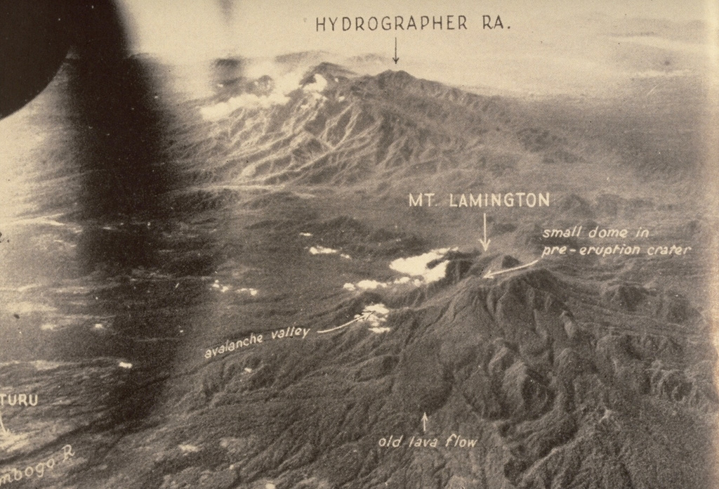
The Hydrographers Range is a forested, deeply dissected andesitic volcanic massif extending from the eastern margin of Mount Lamington north to the coast of eastern Papua New Guinea. Most activity took place during the Pleistocene, but perfectly preserved cinder cones and explosion craters on the southern side of the range suggested that some activity took place during the Holocene (Taylor, 1958). Other well-preserved cones are situated in the high country overlooking Songade village on the coast.
Wikipedia 요약
영어 요약The Hydrographers Range is a forested mountain range in the Oro Province of southeastern Papua New Guinea. It extends from the eastern margin of Mount Lamington in the west to the Pacific Ocean coast in the east.
Wikipedia · CC BY-SA · 전체 기사 보기 →
분화 이력
용어집상세 타임라인
분화 기록이 없습니다.
주변 화산
외부 링크
⚠ 참고용 정보입니다. 재난 대응에 사용하지 마세요.