본문으로 건너뛰기

파푸아뉴기니 · 용암돔

Iamalele

화산 유형
용암돔
해발
194m
마지막 분화
미확인
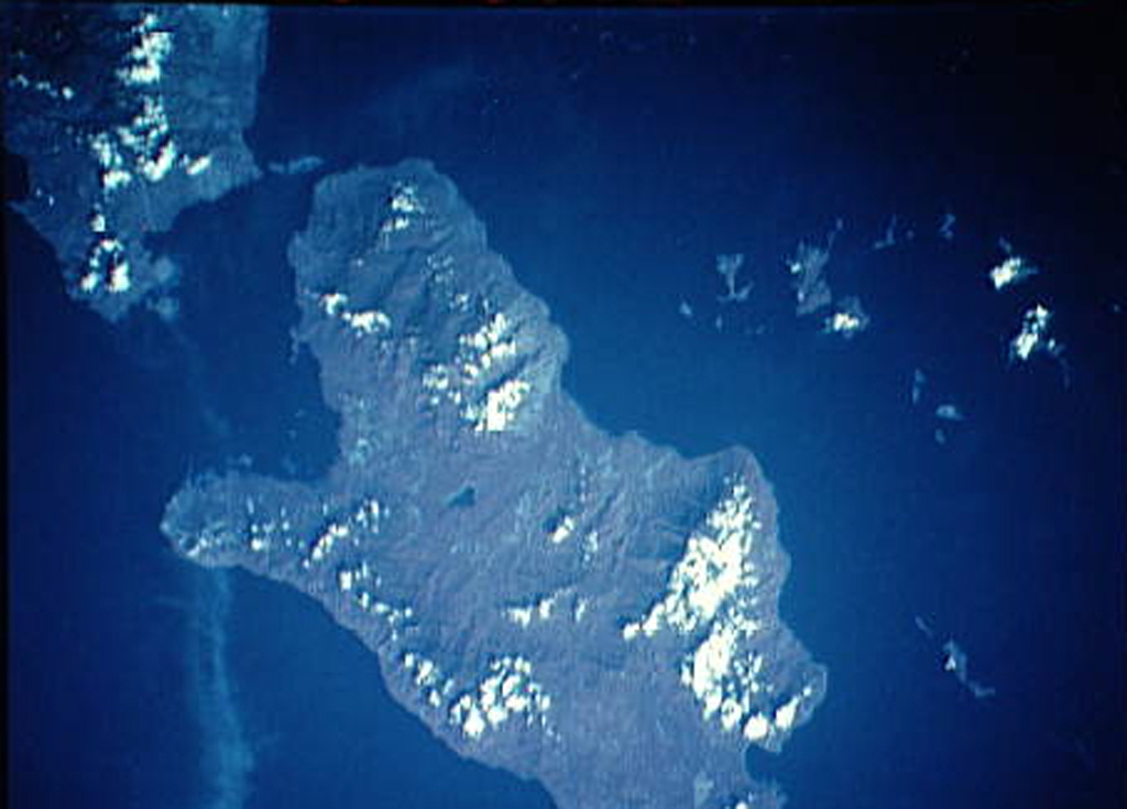
Late Cenozoic volcanic rocks cover much of the Kukuia Peninsula (left center) on the SW side of Fergusson Island and areas north of the peninsula. The Iamalele-Fagululu area, located north of the peninsula and south of the Mailolo metamorphic block forming the NW tip of the island, contains a series of lava domes and lava flows and abundant hot springs and fumaroles. Eight small lava domes are located near Fagululu village and around Salt Lake. Young volcanic rocks are also present on Goodenough Island (upper left).
Late Cenozoic volcanic rocks cover much of the Kukuia Peninsula (left center) on the SW side of Fergusson Island and areas north of the peninsula. The Iamalele-Fagululu area, located north of the peninsula and south of the Mailolo metamorphic block forming the NW tip of the island, contains a series of lava domes and lava flows and abundant hot springs and fumaroles. Eight small lava domes are located near Fagululu village and around Salt Lake. Young volcanic rocks are also present on Goodenough Island (upper left). · 사진: NASA Space Shuttle image STS44-83-80, 1991 (http://eol.jsc.nasa.gov/).
화산 유형
용암돔
국가
파푸아뉴기니
지역
남서태평양 / Trobriand Volcanic Province
해발
194m
좌표
-9.506, 150.524
마지막 분화
미확인
판구조 환경
섭입대 / 대륙 지각 (> 25 km)
화산 지형
화산군
주요 암석
안산암 / 현무암질 안산암

지질학적 요약

영어 원문

Multiple volcanic features and active thermal areas are located on the SW part of Fergusson Island, in the center of the D'Entrecasteaux island group.

출처: Global Volcanism Program, Smithsonian Institution (발췌) · GVP에서 전체 요약 읽기 →

분화 이력

용어집

상세 타임라인

분화 기록이 없습니다.

주변 화산

외부 링크

⚠ 참고용 정보입니다. 재난 대응에 사용하지 마세요.