イエメン · 火山原
Harra es-Sawad
Sawad, Harra Es-
- タイプ
- 火山原
- 標高
- 1737m
- 最終噴火
- 1253年
- タイプ
- 火山原
- 国
- イエメン
- 地域
- アラビア・中央アジア / Southwest Arabia Volcanic Province
- 標高
- 1737m
- 座標
- 13.580, 46.120
- 最終噴火
- 1253年
- テクトニクス環境
- プレート内部 / 大陸地殻 (> 25 km)
- 火山地形
- 火山群
- 主要岩石
- 粗面玄武岩 / テフライト・バサナイト
地質学的概要
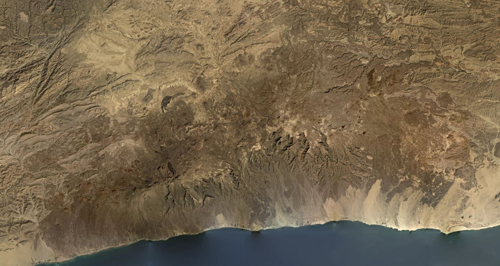
The Harra es-Sawâd (or Shuqra) volcanic field in southern Yemen extends for nearly 100 km along the Gulf of Aden, east of the city of Shuqra (Shaqra). The field is oriented WSW-ENE and contains about a hundred cones that have sent lava flows across a 40 x 95 km area of faulted basement limestones. Most of the volcanic field is Holocene in age (Cox et al., 1977), and in many cases the flows and cones are essentially uneroded. The only recorded event was a major, but poorly documented, eruption in 1253 CE.
噴火履歴
1件の記録用語集概要 (VEI時系列)
バーをクリックすると個別の噴火が表示されます · 矢印キーで棒を移動、Enterで表示
詳細タイムライン
- 1253年VEI 3観測記録1253 ~ 終了日不明
近くの火山
外部リンク
⚠ 参考情報です。緊急対応には使用しないでください。