本文へスキップ
地図に戻る
比較地図で見る

パプアニューギニア · 火山原

Dawson Strait Group

タイプ
火山原
標高
500m
最終噴火
1350年
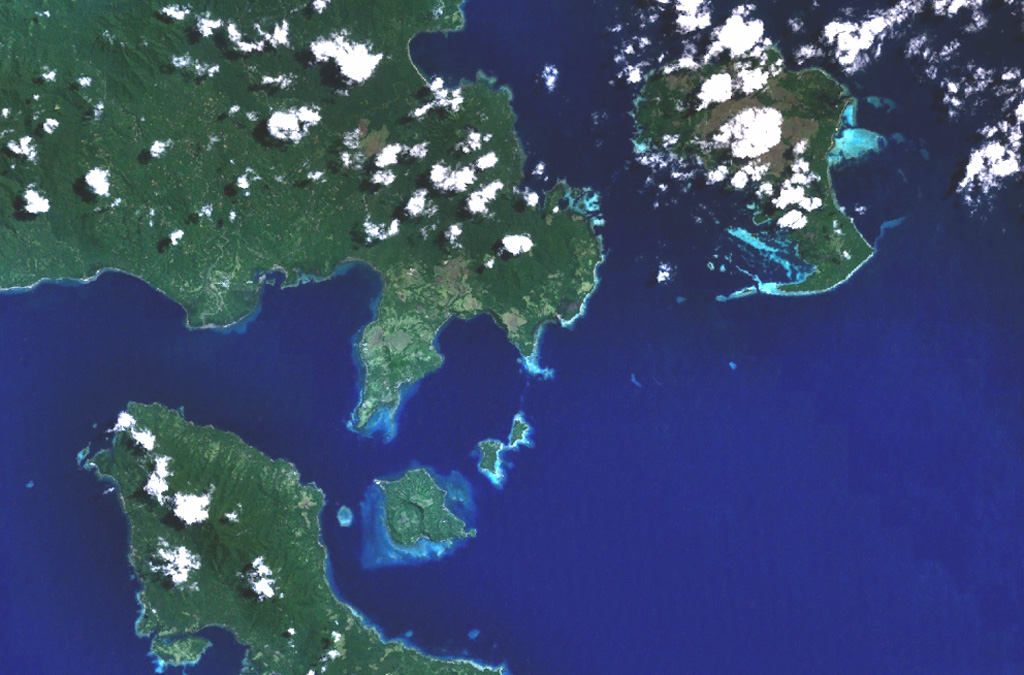
The Dawson Straits, seen in this NASA Landsat image, is located between eastern Fergusson Island (upper left) and northwestern Normanby Island (lower left) in the D'Entrecasteaux island group. The area contains a volcanic field with several young volcanic centers that erupted rhyolitic obsidian flows. Mount Oiau is located on the narrow peninsula (left center) forming the southernmost point on Fergusson Island. A large crater is visible on Dobu Island, southeast of Oiau. Young volcanic rocks are also found on Sanaroa Island (upper right).
The Dawson Straits, seen in this NASA Landsat image, is located between eastern Fergusson Island (upper left) and northwestern Normanby Island (lower left) in the D'Entrecasteaux island group. The area contains a volcanic field with several young volcanic centers that erupted rhyolitic obsidian flows. Mount Oiau is located on the narrow peninsula (left center) forming the southernmost point on Fergusson Island. A large crater is visible on Dobu Island, southeast of Oiau. Young volcanic rocks are also found on Sanaroa Island (upper right). · 写真: NASA Landsat 7 image, 1999-2003 (courtesy of NASA Worldwind).
タイプ
火山原
国
パプアニューギニア
地域
南西太平洋 / Trobriand Volcanic Province
標高
500m
座標
-9.620, 150.880
最終噴火
1350年
テクトニクス環境
沈み込み帯 / 大陸地殻 (> 25 km)
火山地形
火山群
主要岩石
流紋岩

地質学的概要

英語の原文

The Dawson Straits, located between eastern Fergusson and western Normanby Islands in the D'Entrecasteaux island group, contains a volcanic field with several centers that define a possible partly submerged caldera.

出典:Global Volcanism Program, Smithsonian Institution(抜粋) · GVP で全文を読む →

噴火履歴

1件の記録用語集

記録の概要

確認された噴火
1件
不確実な噴火
0件
確認された記録の範囲
1350年 ~ 1350年
確認された最大の噴火
VEI の記録なし
1900年以降の確認された噴火
0件
概要 (VEI時系列)
バーをクリックすると個別の噴火が表示されます · 矢印キーで棒を移動、Enterで表示
1350~1350 · 1件 · 最大 VEI ?13501350135113511351

詳細タイムライン

  1. 1350年VEI ?地質学的推定
    1350 ~ 終了日不明
    Oiau

近くの火山

外部リンク

⚠ 参考情報です。緊急対応には使用しないでください。